

Context
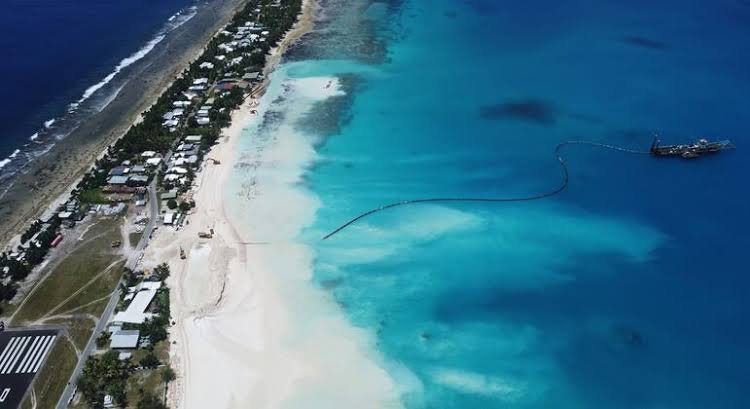
The UN General Assembly (UNGA) adopted its first declaration on sea-level rise in September 2026, addressing the continuity of statehood and maritime rights of vulnerable island nations. It also highlights the need to integrate rising sea levels into coastal planning and strengthen support for at-risk countries.
Causes and Trends of Sea-Level Rise
- Causes: Global warming raises sea levels through thermal expansion of seawater, melting of glaciers and ice sheets in Greenland and Antarctica, and changes in land-water storage due to human activities.
- Rising Trend: According to the World Meteorological Organization (WMO), the rate of global sea-level rise increased from 2.1 mm/year (1993–2002) to 4.7 mm/year (2015–2024). Global mean sea level reached a record high in 2024.
Key Features of the UN Declaration
- Continuity of Statehood: Sea-level rise and territorial submergence do not automatically end a state’s existence, sovereignty, rights, or UN membership.
- Stable Maritime Zones: Supports maintaining established maritime zones despite changing coastlines, in accordance with international law, particularly UNCLOS.
- Protection of Populations: Highlights risks to coastal settlements, livelihoods, and infrastructure. Around 770 million people live less than five metres above the high-tide line, according to a UN report on sea-level rise and human rights.
- Risk-informed Planning: Calls for incorporating sea-level projections into the planning, construction, and maintenance of critical coastal infrastructure.
- Early Warning and Adaptation: Encourages multi-hazard early warning systems, climate-risk assessments, and anticipatory action to reduce coastal vulnerability.
- International Cooperation: Calls for greater financial, technical, and policy support for developing countries, particularly Small Island Developing States (SIDS) and Least Developed Countries (LDCs).
- Nature-based Solutions: Promotes the protection and restoration of mangroves, kelp forests, and seagrass meadows to strengthen coastal resilience.
Implications for India and Key Challenges
- Coastal Erosion: The National Centre for Coastal Research (NCCR) found that 33.6% of India’s coastline was vulnerable to erosion during 1990–2018, while 26.9% experienced land gain (accretion).
- Threat to Islands and Maritime Interests: Sea-level rise threatens the habitability and ecosystems of Lakshadweep and the Andaman and Nicobar Islands, while unstable maritime boundaries could affect India’s rights over marine resources under UNCLOS.
- Loss of Land and Ecosystems: In the Sundarbans (West Bengal), erosion and flooding threaten mangroves and island communities. Ghoramara Island has suffered substantial land loss, increasing displacement risks.
- Coastal Flooding and Livelihood Losses: Mumbai, Chennai, and Kolkata face inundation risks. Saltwater intrusion threatens agricultural land and freshwater supplies, while erosion affects fishing, tourism, and port infrastructure.
- Coastal Regulation Gaps: The Coastal Regulation Zone (CRZ) Notification, 2019, does not adequately address future sea-level rise and shoreline changes, while the Survey of India’s hazard line is used mainly for disaster management.
- Lack of Displacement Protection: India lacks a comprehensive legal framework for gradual displacement caused by coastal erosion and sea-level rise, including secure land rights and livelihood support.
- Climate-Finance Gap: The UNEP estimates developing countries will need US$310–365 billion annually by 2035 for climate adaptation, compared with US$26 billion in international public adaptation finance in 2023.
Way Forward
- Risk-Based Coastal Planning: Integrate sea-level projections, hazard lines, and erosion rates into coastal zoning, land use, and infrastructure planning.
- Protection of Displaced Communities: Develop a legal framework for planned relocation, ensuring compensation, secure land rights, and livelihood restoration.
- Ecosystem-Based Adaptation: Restore mangroves, wetlands, coral reefs, and coastal dunes to reduce erosion, flooding, and storm-surge impacts.
- Climate-Resilient Infrastructure and Finance: Strengthen drainage, early-warning systems, and protective infrastructure, supported by adequate and accessible adaptation finance.
- International Cooperation: Implement the UN declaration, clarify legal issues concerning statehood and maritime zones, and strengthen support for vulnerable countries under the principle of Common but Differentiated Responsibilities and Respective Capabilities (CBDR-RC).
FAQs
Q1. What is the main objective of the UN Declaration on Sea-Level Rise?
Ans. It addresses the legal and practical challenges of sea-level rise, especially for vulnerable island nations and coastal communities.
Q2. What is a coastal hazard line?
Ans. It is a line mapped by the Survey of India to identify coastal risks and support disaster management and adaptation planning.
Q3. What is the principle of Common but Differentiated Responsibilities and Respective Capabilities (CBDR-RC)?
Ans. CBDR-RC recognises that all countries share climate responsibilities, but developed countries should take greater action based on their historical emissions and greater capabilities.