
Context
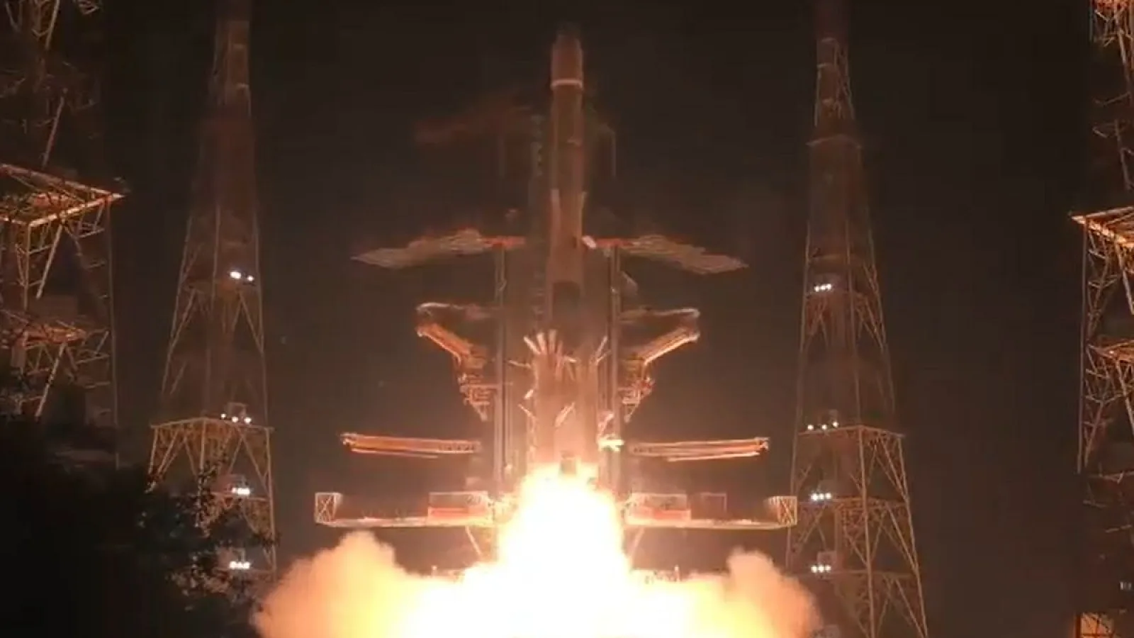
In October 2026, ISRO launched a navigation satellite aboard a Geosynchronous Satellite Launch Vehicle (GSLV) from the Satish Dhawan Space Centre, Sriharikota, Andhra Pradesh. The satellite was placed into a Geosynchronous Transfer Orbit (GTO). The launch aims to strengthen India’s independent regional navigation system, known as Navigation with Indian Constellation (NavIC).
What is NavIC?
- Full Form: Navigation with Indian Constellation (NavIC).
- Earlier Name: Indian Regional Navigation Satellite System (IRNSS).
- Developed by: Indian Space Research Organisation (ISRO).
- Operational Services: NavIC’s operational services began in 2018.
- Objective: To provide accurate Positioning, Navigation and Timing (PNT) services over India and the surrounding region.
- Indigenous System: It provides India with an independent navigation capability instead of relying entirely on foreign systems such as the US-operated Global Positioning System (GPS).
Satellite Configuration of NavIC
NavIC is designed as a regional satellite navigation constellation.
- It consists of seven satellites in its baseline configuration:
- Four satellites in Geosynchronous Earth Orbit (GEO).
- Three satellites in Geostationary Earth Orbit (GSO).
- These satellites work together to provide navigation coverage over India and the surrounding region.
Key Terms
|
NVS-03: Key Features of the Newly Launched Satellite
The satellite launched in this mission is NVS-03, the third satellite in India’s next-generation navigation satellite series.
- Indigenous Atomic Clock: It carries an indigenous atomic clock along with procured atomic clocks. Atomic clocks provide highly precise time measurements, which are essential for satellite navigation.
- Additional L1 Frequency: It introduces the L1 signal band alongside the existing L5 and S-band signals, improving NavIC’s service capabilities.
- Coverage: It is designed to provide coverage over India’s landmass and a region extending approximately 1,500 km beyond India’s geopolitical boundary.
Applications of NavIC
NavIC provides two important categories of services:
- Standard Positioning Service (SPS): Available for civilian users.
- Restricted Service (RS): An encrypted service intended for authorised users, including strategic and defence applications.
Major Applications:
- Agriculture: Supports location-based agricultural operations, including precision farming and the tracking of agricultural machinery.
- Defence: Helps in navigation, positioning and timing for strategic military operations.
- Transportation: Supports vehicle tracking and navigation.
- Maritime sector: Helps fishermen and ships with navigation and location information.
- Disaster Management: Can support emergency response, search and rescue operations.
- Telecommunications: Provides accurate timing information needed for synchronising communication networks.
What is GSLV?
- Full Form: Geosynchronous Satellite Launch Vehicle.
- Developed by: Indian Space Research Organisation (ISRO).
- Purpose: Primarily designed to place communication, meteorological and other satellites into geosynchronous transfer orbits.
- Propulsion: It is a three-stage launch vehicle that uses solid, liquid and cryogenic propulsion stages.
- Cryogenic Engine: Its cryogenic upper stage uses liquid hydrogen as fuel and liquid oxygen as oxidiser.
- About the GSLV-F18 Mission: It was the 20th flight of India’s GSLV. It successfully launched the NVS-03 navigation satellite in October 2026 from the Satish Dhawan Space Centre, Sriharikota.
Significance of NavIC for India
- Strategic Autonomy: Reduces India’s dependence on foreign navigation systems for critical applications.
- National Security: Provides an independent navigation capability for authorised defence and strategic users.
- Economic Applications: Supports transportation, agriculture, fisheries, logistics and other location-based services.
- Disaster Management: Provides positioning and timing support during emergencies and natural disasters.
- Technological Self-Reliance: Strengthens India’s capabilities in satellite navigation, atomic clocks and indigenous space technology.
Frequently Asked Questions (FAQs)
Q1. What is NavIC, and what is its primary objective?
Navigation with Indian Constellation (NavIC), earlier known as IRNSS, is India’s indigenous regional navigation system developed by ISRO to provide Positioning, Navigation and Timing (PNT) services over India and its surrounding region.
Q2. What is the baseline satellite configuration of NavIC?
NavIC is designed with seven satellites: four in Geosynchronous Earth Orbit (GEO) and three in Geostationary Earth Orbit (GSO), providing regional navigation coverage.
Q3. What are the key features of the NVS-03 satellite?
NVS-03 carries an indigenous atomic clock, introduces the L1 frequency band alongside existing L5 and S-band signals, and provides coverage extending approximately 1,500 km beyond India’s geopolitical boundary.