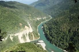


Context
The India Meteorological Department (IMD) recently clarified that the floods in Upper Assam were not caused by cloudbursts, rejecting reports that cloudbursts had occurred in Assam and Nagaland.
About Cloudburst
- A cloudburst is an extreme weather event marked by very intense rainfall over a small geographical area within a short period.
- Although cloudbursts can occur in plains, they are most common in hilly and mountainous regions, particularly the Himalayan region.
- According to the India Meteorological Department (IMD), a cloudburst occurs when 10 cm or more of rainfall is recorded within one hour over an area of about 20–30 sq. km.
- Cloudbursts are highly localised events and should not be confused with widespread heavy rainfall associated with the monsoon.
Formation of Cloudbursts
- The process begins with convection, in which warm, moisture-laden air rises rapidly into the atmosphere.
- In mountainous regions, the rising air is forced upward by steep slopes through orographic lifting.
- As the air cools, it condenses to form cumulonimbus clouds, which can grow up to 15 km in height.
- Strong upward air currents (updrafts) keep water droplets suspended inside the cloud, allowing them to combine into larger droplets.
- When the droplets become too heavy or the updrafts weaken, a large volume of water is released over a short period, resulting in a cloudburst.
Impacts of Cloudbursts
- Trigger flash floods, landslides, and soil erosion, particularly in mountainous regions.
- Cause extensive damage to lives, property, transport networks, and public infrastructure.
- Lead to river overflow, disrupt transport and communication networks, and interrupt essential public services.
UPSC FAQs
Q1. What is a cloudburst?
Ans: A cloudburst is an extreme rainfall event in which 10 cm or more of rain falls within one hour over a small area of about 20–30 sq. km, as defined by the India Meteorological Department (IMD).
Q2. Which type of cloud is mainly associated with cloudbursts?
Ans: Cloudbursts are primarily associated with cumulonimbus clouds, which are tall, vertically developed clouds capable of producing intense rainfall and thunderstorms.
Q3. Why are cloudbursts more common in the Himalayan region?
Ans: The Himalayan terrain forces moisture-laden winds to rise through orographic lifting, creating favourable conditions for the formation of intense, localised rainfall.
Q4. How does a cloudburst differ from normal heavy rainfall?
Ans: A cloudburst is a highly localised event involving very intense rainfall within a short duration, whereas heavy rainfall generally extends over a larger area and lasts for a longer period.
Q5. What are the major impacts of cloudbursts?
Ans: Cloudbursts can cause flash floods, landslides, soil erosion, river overflow, infrastructure damage, and significant loss of life and property, particularly in mountainous regions.
Q6. What is orographic lifting?
Ans: Orographic lifting is the upward movement of moist air when it encounters a mountain barrier. As the air rises, it cools and condenses, promoting the formation of clouds and rainfall.