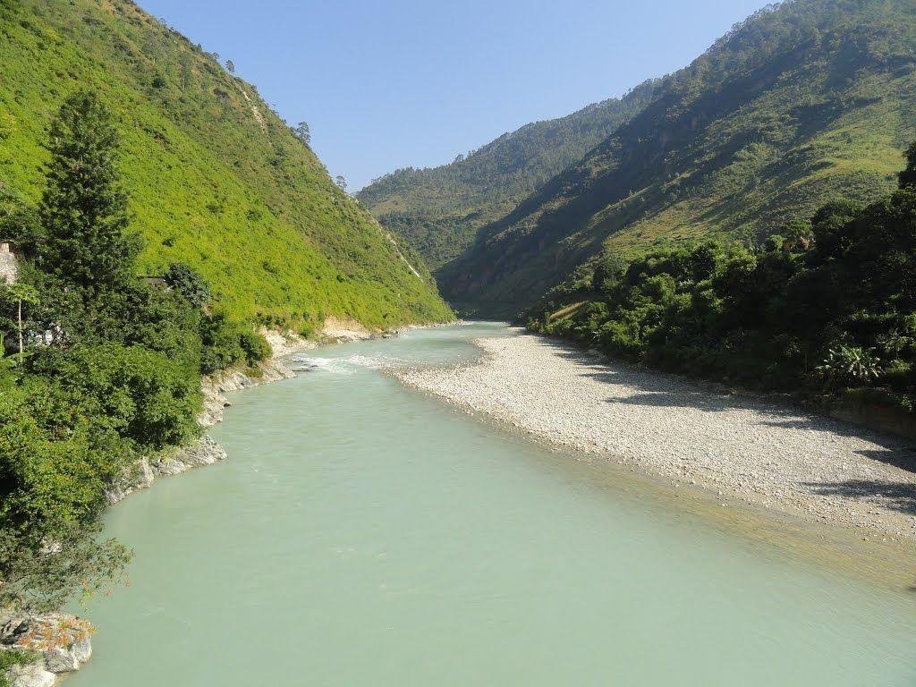
The Kosi River is a significant transboundary river system flowing through China (Tibet), Nepal, and India. Renowned as one of the largest tributaries of the Ganges, it is equally infamous for its volatile nature and devastating floods. Its unique hydrological profile, characterized by high sediment loads and frequent course shifts, makes it a critical subject of study in Indian geography and disaster management.
The river has recently made headlines as the flood situation in Bihar intensified following the breaching of embankments on the Kosi and Bagmati rivers, highlighting the ongoing challenges of managing this “unruly” watercourse.
Geographical Overview and Transboundary Course
The Kosi River is a vital part of the Himalayan drainage system, serving as a lifeline and a threat to the regions it traverses.
Origin and Formation
- The Three Streams: The Kosi is formed by the confluence of three primary Himalayan streams: the Sun Kosi, the Arun Kosi, and the Tamur Kosi.
- Himalayan Source: These headwaters originate in the high-altitude regions of Nepal and Tibet (China).
- The Chatra Gorge: Roughly 48 km (30 miles) north of the Indo-Nepal border, the river is joined by other major tributaries and carves its way southward through the Siwalik Hills via the narrow and deep Chatra Gorge.
Path Through India
- Entry into Bihar: After exiting the gorge, the river emerges into the Great Plains of Northern India in the state of Bihar.
- Confluence with Ganga: It travels a total course of approximately 724 km (450 miles) before finally merging with the Ganges River south of Purnea.
Basin Hydrology and Territorial Limits
The Kosi basin is vast, though its distribution across political borders is uneven, leading to complex international water management issues.
- Drainage Area: The river drains a total area of 74,500 sq.km.
- Territorial Distribution: Out of the total basin, only 11,070 sq.km (approximately 15%) lies within Indian Territory, while the remainder is in Nepal and Tibet.
- Basin Boundaries: The Kosi valley is geographically isolated by steep margins. It is bounded by:
- North: The Yarlung Zangbo River basin.
- East: The Mahananda River basin.
- West: The Gandaki River basin.
- South: The main channel of the Ganges.
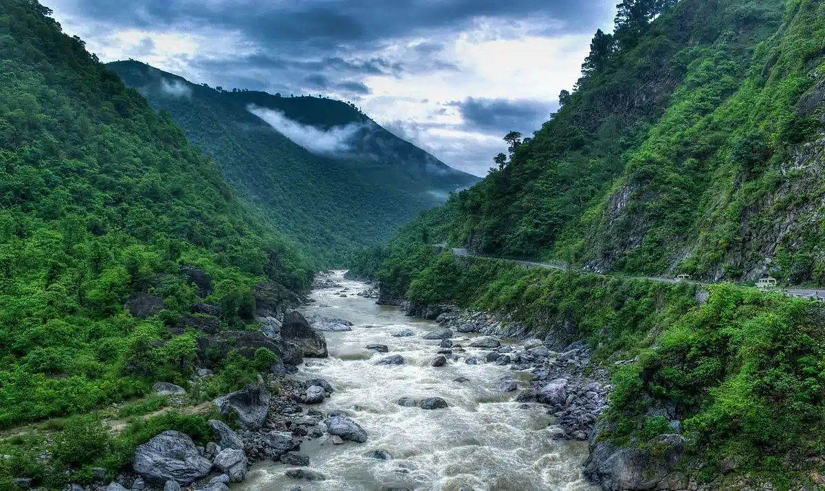
The “Sorrow of Bihar”: Why the Kosi Changes Course
The Kosi River is historically known as the “Sorrow of Bihar” due to the immense human suffering, loss of life, and destruction of property caused by its unpredictable behavior.
- High Debris and Siltation: The river carries an exceptionally high volume of debris and silt from the Himalayas. This sediment settles on the riverbed in the plains, raising the bed level and forcing the water to break its banks.
- Lack of Permanent Channel: Because of the constant “outflushing” of debris, the Kosi lacks a stable or permanent channel in the North Indian plains.
- Westward Migration: The river is famous for shifting its course, primarily in a westward direction. Over the last 200 years, the Kosi has migrated westward by nearly 112 km.
- Agricultural Devastation: This lateral movement has laid waste to vast tracts of fertile agricultural land, turning once-productive fields into sandy, waterlogged marshes.
The Tributary Network: Saptakoshi
The Kosi is often called the “Saptakoshi” (Seven Kosis) in Nepal due to its seven major Himalayan tributaries that converge to form the main stem.
- Sun Koshi
- Tama Koshi (or Tamba Koshi)
- Dudh Koshi
- Indravati
- Likhu
- Arun
- Tamore (or Tamar)
The Kosi in the Context of the Ganges River System
As a primary left-bank tributary, the Kosi is an integral part of the larger Ganga drainage basin.
- Left-Bank Tributaries of Ganga: These include the Ramganga, Gomti, Ghaghara, Gandak, Kosi, and Mahananda.
- Right-Bank Tributaries of Ganga: These include the Yamuna, Tamsa, Son, and Punpun.
FAQs: Key Facts about the Kosi River
WHICH THREE COUNTRIES DOES THE KOSI RIVER FLOW THROUGH?
The Kosi is a transboundary river that flows through China (Tibet), Nepal, and India.
WHY IS THE KOSI RIVER CALLED THE “SORROW OF BIHAR”?
It is called the “Sorrow of Bihar” due to its frequent and devastating floods and its tendency to rapidly change its course, leading to widespread destruction.
WHERE DOES THE KOSI RIVER ORIGINATE?
The river is formed by the confluence of three Himalayan streams—the Sun Kosi, Arun Kosi, and Tamur Kosi—which originate in the glaciers of Nepal and Tibet.
WHAT IS THE CHATRA GORGE?
The Chatra Gorge is a narrow canyon in the Siwalik Hills of Nepal where the Kosi River breaks through before entering the plains of India.
HOW MUCH OF THE KOSI’S DRAINAGE AREA LIES IN INDIA?
Out of a total drainage area of 74,500 sq.km, only 11,070 sq.km is located within the Indian state of Bihar.
WHAT IS THE TOTAL LENGTH OF THE KOSI RIVER?
The river flows for approximately 724 km (450 miles) from its Himalayan headwaters to its confluence with the Ganges.
WHICH ARE THE SEVEN MAJOR TRIBUTARIES OF THE KOSI?
The seven tributaries are the Sun Koshi, Tama Koshi, Dudh Koshi, Indravati, Likhu, Arun, and Tamore.
IN WHICH DIRECTION DOES THE KOSI RIVER TEND TO SHIFT?
The Kosi River historically tends to shift its course in a westward direction.
WHERE DOES THE KOSI RIVER JOIN THE GANGES?
The Kosi enters the Ganges River south of Purnea in Bihar.
WHICH RIVER BASIN BOUNDS THE KOSI TO THE EAST?
The Kosi River valley is bounded by the Mahananda River basin to the east.