
Context
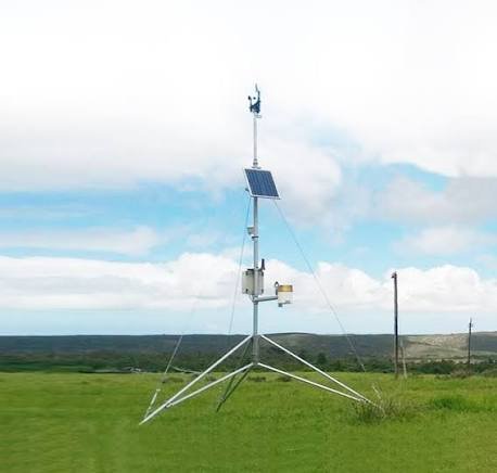
The Weather Information Network and Data System (WINDS) project is facing delays due to a shortage of land for installing automatic rain gauges and weather stations across different states. The project aims to improve India’s weather data infrastructure, particularly for agriculture.
About WINDS
- WINDS is a national initiative under the Pradhan Mantri Fasal Bima Yojana (PMFBY).
- Its main objective is to establish a nationwide network of weather-monitoring stations to provide hyperlocal weather data (weather information specific to a small geographical area).
- It uses two types of equipment:
- Automatic Weather Stations (AWS): Collect different weather-related information.
- Automatic Rain Gauges (ARG): Measure rainfall.
- These instruments collect weather data at the Block and Gram Panchayat levels.
- The collected data from the India Meteorological Department (IMD), State Governments and public and private organisations is integrated into a single national-level WINDS portal.
- The project is implemented by the Ministry of Agriculture and Farmers Welfare through the Mahalanobis National Crop Forecast Centre (MNCFC).
Key Features and Importance
- Better weather information: Provides farmers with local weather data to help them make informed agricultural decisions.
- Improved crop insurance: Helps calculate insurance estimates and payouts under PMFBY using weather-related information.
- Data integration: Brings weather information from multiple agencies onto a common platform.
- Nationwide coverage: Aims to establish a large network of weather stations across India.
- Grassroots-level planning: Helps farmers, policymakers and other stakeholders understand local weather conditions and make better decisions.
Frequently Asked Questions (FAQs)
Q1. What is the Weather Information Network and Data System (WINDS)?
WINDS is a national initiative under the Pradhan Mantri Fasal Bima Yojana (PMFBY) aimed at establishing a nationwide network of weather-monitoring stations for providing hyperlocal weather data.
Q2. What are the two types of equipment used under WINDS?
WINDS uses Automatic Weather Stations (AWS) to collect different weather-related information and Automatic Rain Gauges (ARG) to measure rainfall at the Block and Gram Panchayat levels.
Q3. How does WINDS benefit farmers?
WINDS provides farmers with local weather information, helping them make informed agricultural decisions, understand changing weather conditions and plan farming activities more effectively.
Q4. How does WINDS improve crop insurance?
WINDS provides weather-related data that helps calculate insurance estimates and payouts under PMFBY, improving the availability of local weather information for crop insurance assessments.
Q5. Which ministry implements WINDS, and what is its implementation challenge?
The Ministry of Agriculture and Farmers Welfare implements WINDS through MNCFC. Its implementation faces delays due to insufficient land for installing automatic rain gauges and weather stations.