
About NaVIC
- NavIC (Navigation with Indian Constellation) is India’s indigenous regional satellite navigation system developed by ISRO.
- It was earlier known as the Indian Regional Navigation Satellite System (IRNSS).
- Its primary objective is to provide independent Positioning, Navigation and Timing (PNT) services without relying entirely on foreign navigation systems such as the United States’ Global Positioning System (GPS).
- It provides coverage over India and approximately 1,500 km beyond its geopolitical boundary.
Services provided by NavIC
- Standard Positioning Service (SPS): An open service available to civilian users.
- Restricted Service (RS): An encrypted service available to authorised strategic users, including defence and security agencies.
Structure of the NavIC Satellite Constellation
NavIC was originally designed as a constellation of seven satellites:
- Three satellites in Geostationary Orbit (GEO).
- Four satellites in Geosynchronous Orbit (GSO) with inclined orbits.
- A network of ground stations supports satellite monitoring and navigation services.
Difference between GEO and GSO
| Geostationary Orbit | Geosynchronous Orbit |
| The satellite appears stationary relative to a point on Earth. | The satellite completes one orbit in approximately one sidereal day. |
| Circular orbit above the equator. | May be inclined or elliptical. |
| A special type of geosynchronous orbit. | Includes geostationary orbits. |
All geostationary satellites are geosynchronous, but all geosynchronous satellites are not geostationary.
Factors Behind the Declining Operational Capability of NavIC
- Ageing satellites: Several first-generation IRNSS satellites completed their intended mission lives, reducing the number of operational satellites.
- Atomic clock failures: Some satellites experienced failures in their atomic clocks, affecting their navigation capabilities.
- IRNSS-1F decommissioning: It completed its 10-year mission life in March 2026.
- NVS-02 setback: Although successfully launched in January 2025, NVS-02 could not reach its intended orbital position because its oxidiser valves failed to open during orbit-raising operations.
Impact on NavIC:
- By March 2026, only three satellites were providing the relevant navigation services.
- At least four operational satellites are required for basic standalone positioning.
- Consequently, NavIC could continue providing timing services but could not independently provide basic positioning services.
- This created a gap in India’s independent navigation capabilities and increased the importance of subsequent satellite launches.
About NVS-03
- NVS-03 is a second-generation navigation satellite developed by ISRO as part of the NavIC system.
- It is designed to provide Positioning, Navigation and Timing (PNT) services to users in India and the surrounding region.
- It is part of the effort to maintain and modernise NavIC’s satellite constellation.
Key Features of NVS-03
- Indigenous atomic clock: It carries an indigenous atomic clock to support accurate timekeeping, which is essential for satellite navigation.
- Additional L1 frequency: It adds the L1 frequency to the existing L5 and S-band signals, improving compatibility with civilian navigation receivers.
- Second-generation technology: It belongs to the NVS series, which is intended to improve the reliability and capabilities of the earlier Indian Regional Navigation Satellite System (IRNSS) satellites.
- Navigation services: It supports the provision of accurate positioning and timing information for civilian and strategic applications.
Importance of NVS-03
- Restoring NavIC capabilities: It is intended to strengthen the operational satellite constellation and support independent positioning services.
- Strategic autonomy: It reduces India’s dependence on foreign navigation systems such as the US Global Positioning System (GPS).
- Improved civilian access: The additional L1 signal can make NavIC more compatible with commonly used civilian navigation devices.
- National security: Indigenous navigation capabilities are important for defence operations, secure communications and strategic applications.
- Disaster management: Reliable location and timing information can support emergency response, rescue operations and disaster monitoring.
Challenges in Strengthening NavIC
- Satellite reliability: Ageing satellites and technical failures can disrupt the continuity of navigation services.
- Limited operational backup: Operating close to the minimum satellite requirement makes the system vulnerable to the failure of another satellite.
- Technological limitations: Developing reliable atomic clocks, navigation payloads and advanced satellite components requires sustained research and investment.
- Limited user adoption: Wider integration into smartphones, automobiles and navigation devices is necessary to realise NavIC’s full potential.
- Ground infrastructure: Effective utilisation requires adequate ground stations, monitoring facilities and application-level infrastructure.
- Global competition: GPS, Galileo, GLONASS and BeiDou have wider coverage and established international user ecosystems.
Way Forward
- Strengthening the constellation: Expedite the deployment of NVS-04, NVS-05 and subsequent satellites to ensure adequate coverage and redundancy.
- Ensuring operational reliability: Develop backup satellites and improve monitoring, maintenance and replacement mechanisms.
- Promoting indigenous technology: Strengthen domestic capabilities in atomic clocks, navigation chips, receivers and satellite components.
- Increasing civilian adoption: Encourage NavIC compatibility in smartphones, automobiles, railway systems and maritime equipment.
- Developing ground infrastructure: Expand monitoring stations and application-level infrastructure for effective utilisation.
- Encouraging private participation: Involve domestic industries and start-ups in developing navigation technologies and commercial applications.
Conclusion
The NVS-03 mission marks an important step towards strengthening India’s indigenous navigation infrastructure. However, the long-term success of NavIC will depend on maintaining a reliable satellite constellation, developing indigenous technologies and ensuring widespread civilian adoption. A robust NavIC system can become a key pillar of India’s strategic autonomy, digital infrastructure and growing space economy.
FAQs
Q1. What is NavIC?
Ans: NavIC is India’s indigenous regional satellite navigation system developed by ISRO.
Q2. What is the coverage area of NavIC?
Ans: It covers India and approximately 1,500 km beyond its geopolitical boundary.
Q3. How many satellites were originally planned under NavIC?
Ans: Seven satellites: three in geostationary orbit and four in inclined geosynchronous orbit.
Q4. Why are four satellites important for NavIC?
Ans: Four satellite signals are required for basic standalone positioning, including the correction of receiver clock errors.
Q5. What is NVS-03?
Ans: It is the third satellite in the second-generation NavIC satellite series.
Q6. Which launch vehicle carried NVS-03?
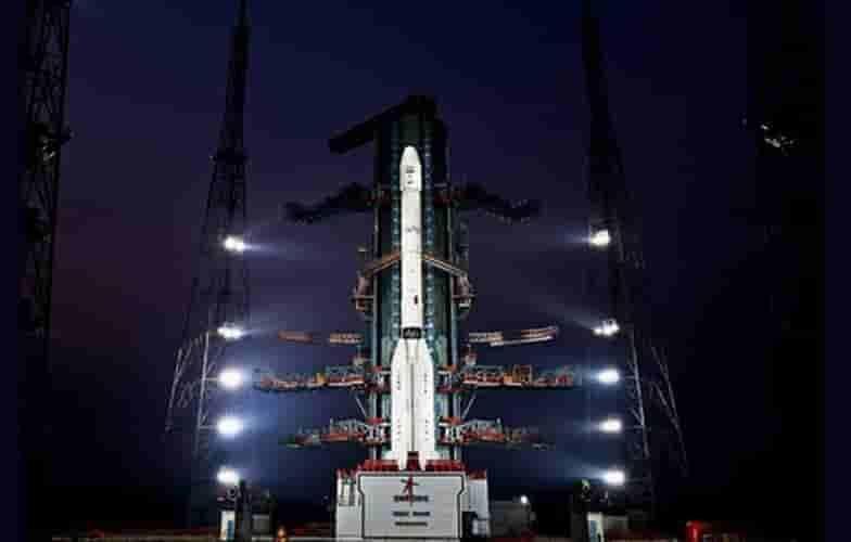
Ans: GSLV-F18, the 20th flight of India’s Geosynchronous Satellite Launch Vehicle.