
Context
Official observations indicate that the Yamuna in Delhi remains severely polluted for most of the year, with temporary improvement during the monsoon due to increased river flow.
About the River
- River System: Longest tributary of the Ganga River and a major river of northern India.
- Origin: Rises from the Yamunotri Glacier, near the Bandarpunch massif in Uttarakhand’s Garhwal Himalayas (altitude: ~4,421 metres).
- Length: Approximately 1,376 km.
- Drainage Basin: Part of the Ganga River Basin, supporting agriculture, drinking water supply, and industries across northern India.
Course and Canal System
1. Upper Course: Flows through the Himalayan valleys of Uttarakhand and enters the Indo-Gangetic Plain near Dakpathar–Paonta Sahib.
2. Plains: Forms parts of the Haryana–Uttar Pradesh boundary before flowing through Delhi.
3. Major Canals:
- Western and Eastern Yamuna Canals: Draw water at Hathnikund Barrage (Haryana).
- Agra Canal: Originates from Okhla Barrage (Delhi).
4. Lower Course: Flows southeast through Uttar Pradesh, passing Mathura, Agra, and Etawah.
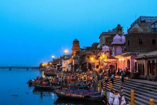
5. Confluence: Merges with the Ganga at Triveni Sangam, Prayagraj, a major religious site linked to the Kumbh Mela.
Major Tributaries (Upstream to Downstream)
| Tributary | Bank | Important Fact |
| Tons | Right | Largest Himalayan tributary; carries more water than the Yamuna at their confluence (near Kalsi, Uttarakhand) |
| Giri | Right | Important Himalayan tributary draining parts of Himachal Pradesh |
| Hindon | Left | Flows through western Uttar Pradesh (Saharanpur to Noida) |
| Chambal | Right | Largest tributary by catchment area; drains the Malwa Plateau and is known for badland topography (ravines) |
| Sind | Right | Flows through Madhya Pradesh and Uttar Pradesh |
| Betwa | Right | Originates in Madhya Pradesh; part of the Ken-Betwa River Interlinking Project |
| Ken | Right | Flows through the Bundelkhand region and Panna Tiger Reserve |
Pollution in the Yamuna River
- Major Sources: Untreated sewage, industrial effluents, agricultural runoff, and reduced freshwater flow.
- Critical Stretch: The 22-km Wazirabad–Okhla stretch in Delhi receives heavy wastewater via urban drains.
- Seasonal Variation: Higher monsoon flow temporarily dilutes pollutants without removing the root pollution sources.
- Recent Water Quality (September 2026): The DPCC (Delhi Pollution Control Committee) recorded a BOD (Biochemical Oxygen Demand) level of 30 mg/L at ISBT (Inter-State Bus Terminus) Bridge, far above the safe bathing standard of 3 mg/L or less.
- Ecological Impact: Organic waste lowers DO (Dissolved Oxygen) levels, threatening aquatic life and degrading the river ecosystem.
FAQs
Q1. Where does the Yamuna River originate?
Ans. The Yamunotri Glacier in Uttarakhand’s Garhwal Himalayas, near the Bandarpunch massif.
Q2. What is the total length of the Yamuna River?
Ans. Approximately 1,376 km, making it the longest tributary of the Ganga.
Q3. Which are the major right-bank tributaries of the Yamuna?
Ans. Tons, Giri, Chambal, Sind, Betwa and Ken.
Q4. Where does the Yamuna join the Ganga?
Ans. At Triveni Sangam, Prayagraj, Uttar Pradesh.
Q5. What does Biochemical Oxygen Demand (BOD) indicate?
Ans. BOD measures the oxygen required by microorganisms to decompose biodegradable organic matter in water. Higher BOD generally indicates greater organic pollution.