

Context
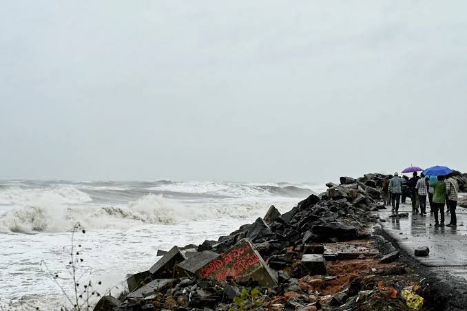
Cyclone Arnab made landfall along the Andhra Pradesh–Yanam coast on 28 October 2026.
Understanding Tropical Cyclones
- Meaning: A tropical cyclone is a rapidly rotating storm system developing over warm tropical or subtropical oceans.
- Characteristics: Low-pressure centre, strong winds, thunderstorms and heavy rainfall.
- Energy Source: Derives energy from the heat and moisture supplied by warm ocean waters.
- Conditions Required for Formation of Tropical Cyclones: Six major conditions favour cyclone formation and intensification:
- Warm ocean water: Sea surface temperature of around 26.5°C or above supplies heat and moisture.
- Atmospheric instability: Rising warm, moist air promotes thunderstorms and deep convection.
- Coriolis force: Earth’s rotation provides the necessary rotational movement; cyclones rarely form within about 5° of the equator.
- Low vertical wind shear: Minimal changes in wind speed and direction with height help maintain the cyclone’s structure.
- High humidity: Moisture in the middle atmosphere supports thunderstorm development and prevents excessive drying.
- Pre-existing low-pressure disturbance: Provides an initial system around which air converges and rotates.
- How does a tropical cyclone intensify? Warm ocean water à Evaporation and supply of moisture à Rising warm, moist air à Condensation and release of latent heat à
Warming of the storm’s core à Fall in atmospheric pressure à Stronger winds and air convergence à Further intensification of cyclone- Latent Heat: It is the heat released when water vapour changes into liquid water during condensation.
What is Cyclone Arnab?
- Cyclone Arnab was a tropical cyclone that developed over the Bay of Bengal in October 2026. It was the first named cyclone of the 2026 North Indian Ocean cyclone season.
- 23 October 2026 – A low-pressure system developed over the southeast Bay of Bengal.
- 26 October 2026 – The system intensified into Cyclone Arnab.
- 26–27 October 2026 – It rapidly strengthened into a Very Severe Cyclonic Storm.
- 27 October 2026 – The IMD issued warnings and forecast landfall along the Andhra Pradesh coast.
- 28 October 2026 – It crossed the Andhra Pradesh–Yanam coast with sustained winds of 125–135 kmph and higher gusts.
- After landfall – It weakened into a Severe Cyclonic Storm.
- Major impacts included:
- Uprooting of trees and electric poles.
- Widespread power disruptions.
- Damage to houses, roads and agricultural fields.
- Flooding and waterlogging in vulnerable areas.
- Large-scale evacuation of people from coastal regions.
What Made Cyclone Arnab Unusual?
Cyclone Arnab displayed two unusual characteristics:
- Rapid Intensification: Strengthened from a low-pressure system into a Very Severe Cyclonic Storm within a short period, attaining wind speeds of 125–135 kmph due to favourable oceanic and atmospheric conditions.
- Unusually Sustained Intensity After Landfall: Maintained its intensity for at least six hours after landfall began due to slow movement, prolonged coastal crossing and gradual inland movement.
Understanding El Niño
- El Niño is a climate phenomenon characterised by abnormal warming of sea surface temperatures in the central and eastern equatorial Pacific Ocean.
- It is the warm phase of the El Niño–Southern Oscillation (ENSO), which influences global atmospheric circulation, rainfall, temperature and wind patterns.
- How does El Niño occur?
- Normal conditions:
- Trade Winds: Blow from east to west across the equatorial Pacific.
- Warm Water Movement: Push warm surface water towards Indonesia & Australia.
- Normal conditions:
- Upwelling: Cold water rises from deeper layers near South American coast.
- During El Niño:
- Weak Trade Winds: Trade winds weaken, reducing the westward movement of warm water.
- Eastward Spread: Warm surface water spreads towards the central and eastern Pacific.
- Reduced Upwelling: The rise of cold water near South America weakens.
- Ocean Warming: Sea surface temperatures in the central and eastern Pacific rise above normal.
- Climate Changes: Atmospheric circulation & global rainfall patterns are altered.
- Three phases of ENSO
| Phase | Meaning and characteristics |
| El Niño | Warm phase; abnormal warming of central & eastern equatorial Pacific waters. |
| La Niña | Cold phase; abnormal cooling of central & eastern equatorial Pacific waters. |
| ENSO-neutral | Neutral phase; neither El Niño nor La Niña conditions prevail. |
How did El Niño influence Cyclone Arnab?
- Changes in Ocean Temperatures: El Niño influences oceanic circulation over the Indian Ocean. Warm Bay of Bengal waters provided heat and moisture, favouring Arnab’s development and intensification.
- Changes in Atmospheric Circulation: El Niño alters Walker circulation, pressure distribution and wind patterns. These changes may influence wind shear, moisture availability and cyclone movement, potentially creating favourable conditions for Arnab.
- Shift in Cyclone Formation Location: During certain El Niño years, post-monsoon Bay of Bengal cyclones tend to form at more southerly latitudes. This can influence their tracks and the distribution of cyclone risk along India’s eastern coast. Arnab’s formation and movement towards Andhra Pradesh may be consistent with this pattern.
Impacts of Cyclone Arnab and Changing Cyclone Patterns
- Environmental Impacts
- Coastal Erosion: Strong winds, high waves and storm surges erode beaches and damage coastal ecosystems.
- Flooding: Heavy rainfall causes riverine floods, urban flooding and waterlogging.
- Ecosystem Damage: Mangroves, wetlands, agricultural land and coastal biodiversity are affected.
- Saline Water Intrusion: Storm surges contaminate agricultural fields and freshwater sources, reducing soil fertility and drinking water availability.
- Socio-economic Impacts
- Loss of Life and Property: Strong winds, floods and storm surges damage houses, infrastructure and public utilities.
- Agricultural Losses: Flooding and salinity damage standing crops and affect farmers’ livelihoods.
- Economic Disruption: Fishing, transport, tourism and coastal industries face disruptions.
- Displacement: Evacuations and damage to houses force communities to leave their homes.
- Implications for India’s Disaster Management
- Changing Vulnerability: Coastal regions with historically lower cyclone exposure may also face significant risks due to changing cyclone patterns.
- Climate-resilient Infrastructure: Roads, power networks, communication systems and housing must be designed to withstand extreme weather events.
Conclusion
Cyclone Arnab highlights the complex relationship between ocean temperatures, atmospheric circulation and tropical cyclone behaviour. It underlines the need for India to adopt a climate-informed disaster management approach that combines accurate forecasting, resilient infrastructure and community preparedness.
Additional Information1. Naming of Cyclone Arnab a. Named by: Bangladesh 2. Important facts about cyclone naming a. Naming authority: The Regional Specialised Meteorological Centre (RSMC) for Tropical Cyclones, New Delhi, operated by the India Meteorological Department (IMD), names cyclones over the North Indian Ocean. b. International organisation: WMO/ESCAP Panel on Tropical Cyclones. c. Countries involved: There are 13 member countries (Bangladesh, India, Iran, Maldives, Myanmar, Oman, Pakistan, Qatar, Saudi Arabia, Sri Lanka, Thailand, United Arab Emirates and Yemen) 3. Classification of Cyclones in India: The IMD classifies cyclonic disturbances according to their maximum sustained wind speed. a. Depression: 31–49 kmph b. Deep Depression: 50–61 kmph c. Cyclonic Storm: 62–88 kmph d. Severe Cyclonic Storm: 89–117 kmph e. Very Severe Cyclonic Storm: 118–166 kmph f. Extremely Severe Cyclonic Storm: 167–221 kmph g. Super Cyclonic Storm: 222 kmph or above 4. Important Concepts Related to Cyclones a. Eye – Calm central region of a mature cyclone, characterised by relatively low pressure. b. Eyewall – Ring of intense thunderstorms surrounding the eye, where the strongest winds are generally found. c. Storm Surge – Abnormal rise in sea level caused mainly by cyclone winds and atmospheric pressure. d. Vertical Wind Shear – Change in wind speed or direction with height in the atmosphere. e. Landfall – The process in which the centre of a tropical cyclone moves across a coastline from sea to land. f. Recurvature – Change in a cyclone’s direction of movement, often from westward or north-westward to northward and north-eastward. |
Frequently Asked Questions (FAQs)
Q1: Which country named Cyclone Arnab and how was the name chosen?
Cyclone Arnab was named by Bangladesh. It follows a rotational naming system managed by the WMO/ESCAP Panel on Tropical Cyclones, consisting of 13 member countries.
Q2: What two unusual characteristics did Cyclone Arnab display during its life cycle?
The storm underwent rapid intensification to become a Very Severe Cyclonic Storm in a short window and maintained an unusually sustained intensity for six hours after making landfall.
Q3: How did El Niño contribute to the rapid intensification of Cyclone Arnab?
El Niño altered global atmospheric circulation, creating favourable wind shear and fueling the Bay of Bengal with abnormal heat and moisture to trigger rapid storm strengthening.
Q4: Under what category did Cyclone Arnab make landfall, and what were its wind speeds?
It crossed the coast as a Very Severe Cyclonic Storm, packing maximum sustained wind speeds of 125–135 kmph with even higher localized gusts.