
Context
The Indo-French TRISHNA mission, jointly developed by ISRO and France’s CNES, is scheduled to be launched aboard a PSLV next year, strengthening cooperation in advanced Earth observation.
About TRISHNA Mission
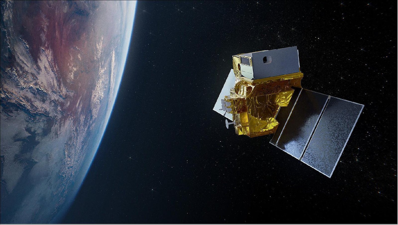
- TRISHNA stands for Thermal Infra-Red Imaging Satellite for High-resolution Natural Resource Assessment. It is a joint Earth-observation mission of ISRO and CNES.
- The satellite will provide high-resolution information on land-surface temperature, surface emissivity, water stress, vegetation and radiation-related parameters.
- Its observations will support surface energy-budget studies from regional to global scales.
Major Objectives of TRISHNA Mission
- Water and energy management: Monitor the energy and water cycles of terrestrial ecosystems to assess water stress and water consumption.
- Water resources: Track water quality and changes in inland and coastal water bodies.
- Urban and geological monitoring: Identify urban heat islands, thermal anomalies associated with volcanic activity, and geothermal resources.
- Cryosphere monitoring: Observe snowmelt runoff and glacier behaviour.
- Atmospheric observations: Generate information on aerosol optical depth, atmospheric water vapour and cloud cover.
Payloads of TRISHNA
The satellite carries two primary payloads, with ISRO and CNES contributing complementary technologies:
| Payload | Agency | Purpose |
| Thermal Infra-Red (TIR) | CNES | Uses a four-channel long-wave infrared sensor to map surface temperature and emissivity at high resolution. |
| VNIR-SWIR | ISRO | Uses seven spectral bands to measure surface reflectance and derive important biophysical and radiation-budget variables. |
Thus, the mission combines thermal infrared observations with visible and short-wave infrared data for a more comprehensive understanding of Earth’s surface.
Key Technical Features of the Mission
- Orbit: Sun-synchronous orbit.
- Altitude: Around 761 km.
- Spatial resolution:
- 57 metres over land and coastal regions.
- 1 km over oceans and polar regions.
- Operational life: 5 years.
The combination of high spatial and temporal resolution will allow TRISHNA to capture changes in Earth’s surface more frequently and precisely.
Significance of the Mission
- Agriculture: Helps identify crop water stress and water use, supporting better irrigation and agricultural planning.
- Climate monitoring: Provides detailed observations relevant to surface temperature, energy balance and climate variability.
- Water security: Supports monitoring of freshwater resources, coastal waters, glaciers and snowmelt.
- Urban planning: High-resolution thermal data can help understand and manage urban heat islands.
- Disaster and geological monitoring: Thermal anomalies can provide useful information on volcanic and geothermal activity.
- Global environmental efforts: TRISHNA data will support initiatives such as GEOGLAM, the UN Sustainable Development Goals (SDGs) and Global Water Watch.
- Some mission outputs will contribute to Essential Agricultural Variables (EAVs) and Essential Climate Variables (ECVs) used by the global scientific community.
Conclusion
TRISHNA combines advanced thermal and multispectral observations to improve understanding of Earth’s water, energy and climate systems. By turning high-resolution satellite data into actionable information, it can strengthen agricultural resilience, water management and climate monitoring.
FAQs
Q1. What is the TRISHNA mission?
It stands for Thermal Infra‑Red Imaging Satellite for High‑resolution Natural Resource Assessment, a joint Earth‑observation mission of ISRO and CNES.
Q2. What are the main objectives of TRISHNA?
Monitoring water and energy cycles, assessing crop water stress, tracking inland/coastal water quality, observing glaciers and snowmelt, and detecting urban heat islands and thermal anomalies.
Q3. What payloads does TRISHNA carry?
- CNES: Thermal Infra‑Red (TIR) sensor for surface temperature/emissivity.
- ISRO: VNIR‑SWIR sensor with seven spectral bands for biophysical and radiation‑budget variables.
Q4. What are TRISHNA’s key technical features?
Sun‑synchronous orbit at ~761 km altitude, spatial resolution of 57 m (land/coastal) and 1 km (oceans/polar), with a 5‑year operational life.
Q5. Why is TRISHNA significant for India and globally?
It strengthens agricultural planning, water security, climate monitoring, urban heat management, and supports global initiatives like GEOGLAM, SDGs, and Global Water Watch.