- Courses
- GS Full Course 1 Year
- GS Full Course 2 Year
- GS Full Course 3 Year
- GS Full Course Till Selection
- MEP (Mains Enrichment Programme) Data, Facts
- Essay Target – 150+ Marks
- Online Program
- GS Recorded Course
- NCERT- First Ladder
- Polity
- Geography
- Economy
- Ancient, Medieval and Art & Culture AMAC
- Modern India, Post Independence & World History
- Environment
- Governance
- Science & Technology
- International Relations and Internal Security
- Disaster Management
- Ethics
- Current Affairs
- Indian Society and Social Issue
- CSAT
- 5 LAYERED ARJUNA Mentorship
- Public Administration Optional
- ABOUT US
- OUR TOPPERS
- TEST SERIES
- FREE STUDY MATERIAL
- VIDEOS
- CONTACT US
Weather Forecasts at Panchayat Level
Weather Forecasts at Panchayat Level
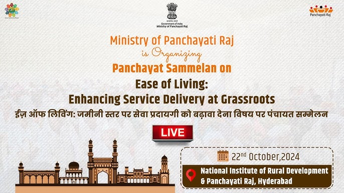
- On October 24, 2024, the Indian government launched the Gram Panchayat-Level Weather Forecasting initiative, which offers five-day weather forecasts updated every hour.
- This marks a significant step towards localized forecasting across the country, aimed at empowering rural communities and enhancing disaster preparedness.
About Gram Panchayat-Level Weather Forecasting initiative:
- This initiative is a joint program of the Panchayati Raj Ministry, the India Meteorological Department (IMD), and the Ministry of Earth Sciences.
- IMD was established in 1875.
- It is the National Meteorological Service of the country and the principal government agency in all matters relating to meteorology and allied subjects.
- Objective: It aims to empower rural communities, enhance disaster preparedness at the grassroots level, and benefit farmers and villagers.
- The initiative is designed to strengthen grassroots governance and promote sustainable agricultural practices, making rural populations more climate-resilient and better equipped to handle environmental challenges.
Forecast Details:
-
Weather forecasts will be accessible on:
- e-GramSwaraj (already operational)
- Gram Manchitra
- Meri Panchayat app
-
Users can access:
- Current temperature
- Wind speed
- Cloud cover (percentage)
- Rainfall
- Relative humidity
- 5-day forecasts for:
- Minimum and maximum temperatures
- Rainfall
- Cloud cover
- Wind direction
- Wind speed
- Overall weather conditions
Benefits to the Public:
- This information will help farmers for better plan agricultural activities, including:
- Sowing
- Irrigation
- Harvesting
- The introduction of localized weather forecasting will serve as a crucial tool to safeguard agricultural livelihoods and enhance rural preparedness against natural disasters.
- Daily updates on temperature, rainfall, wind speed, and cloud cover will empower Gram Panchayats to make informed decisions regarding agricultural practices.
Importance of Localized Forecasting:
- Despite advances in forecasting technology, localized forecasts help to mitigate uncertainties associated with predicting smaller-scale weather events.
- The more precise a forecast is, the greater the inherent uncertainty, particularly for localized events such as cloudbursts.
- The initiative will serve around 2.55 lakh village panchayats across the country, each with resident populations averaging a few thousand.
Current Capabilities of IMD
- Currently, weather forecasting is available at the district and block levels.
- The IMD has developed the capability to forecast weather events over a 12 km x 12 km area and is experimenting with forecasts for 3 km x 3 km grids, aiming for hyper-local forecasts at a 1 km x 1 km level.
Training and Capacity Building
- The Panchayati Raj Ministry is organizing a training workshop on "Weather Forecasts at the Gram Panchayat Level," which will be attended by over 200 participants, including elected representatives of panchayati raj institutions and state officials.
- This training will equip panchayat representatives with the knowledge and skills to effectively utilize weather forecasting tools, enabling informed decision-making and enhancing climate resilience in their communities.
Conclusion
The Gram Panchayat-Level Weather Forecasting initiative represents a transformative step in localized weather prediction in India. By providing timely and accurate weather information, it empowers rural communities, enhances agricultural productivity, and fosters resilience against climate change. This initiative not only supports farmers in making informed decisions but also strengthens grassroots governance amid environmental challenges.

Must Check: Best IAS Coaching In Delhi
UPSC Prelims Result 2024 Out: Expected Cut Off & Other Details, UPSC Prelims 2024 Answer with Explanation, Daily Prelims Quiz, Daily Current Affairs, MONTHLY CURRENT AFFAIRS TOTAL (CAT) MAGAZINE, Best IAS Coaching Institute in Karol Bagh, Best IAS Coaching Institute in Delhi, Daily Mains Question Answer Practice, ENSURE IAS UPSC Toppers, UPSC Toppers Marksheet, Previous Year Interview Questions, UPSC Syllabus

State of the World Population 2025: The Real Fertility Crisis
Updating Economic Indicators: An Important Exercise!
India's Economic Transformation: Infrastructure, Innovation, and Inclusion
Karol Bagh Metro Pillar No. 112, Above Domino's, 22B, First Floor, New Delhi - 110060
Very Important Instruction For Any Issue, Student Must Produce His/Her Fee Receipt. Without Fee Receipt, It Will Not Be Possible To Track Your Details. If You Have Been Given Any Special Consideration, You Must Keep That In Writing And Produce In Case Of Conflict.
Copyright © 2024-2026 ENSURE IAS. All rights reserved.