
Context
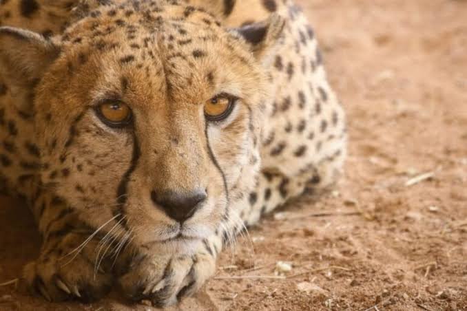
- The death of 19-month-old cheetah KNG22, who was found with five firearm pellets in his body, has raised concerns about wildlife protection under Project Cheetah.
- It has also highlighted a common misconception: satellite collars do not provide continuous, real-time tracking of animals.
- The incident has brought attention to the technological, geographical and operational challenges involved in monitoring highly mobile wild animals.
What Happened to KNG22?
- KNG22, the offspring of Nirva, a South African female cheetah, was found seriously injured in the Sheopur Territorial Forest Division in October 2026.
- He was rescued and taken to Kuno National Park before being shifted to Nanaji Deshmukh Veterinary Science University, Jabalpur, for advanced treatment.
- Medical examinations revealed multiple foreign bodies and damage to internal organs, the musculoskeletal system and the nervous system.
- An emergency surgery recovered five firearm pellets, but the cheetah died.
- The state government formed a Special Task Force comprising forest and police officials to investigate the incident. Six forest department officials were suspended.
How Does Wildlife Tracking Technology Work?
Wildlife monitoring uses a combination of technologies to track animals across large forest areas. At Kuno, the primary technologies include satellite collars and Very High Frequency (VHF) radio receivers.
- Satellite Collars: These are GPS-enabled devices attached to animals to periodically transmit their geographical location to monitoring stations.
- They do not provide continuous live tracking. Instead, they share the animal’s location at fixed intervals.
- At Kuno, satellite collars are programmed to transmit location updates every six hours.
- If one scheduled transmission is missed, the gap may increase to 12 hours. Missing another update can extend it to 18 hours.
- VHF Radio Receivers: They are used by ground teams to locate animals more precisely.
- Satellite collars help identify broad geographical areas where an animal may be present, while VHF equipment helps field teams narrow down its location when they are within radio range.
Challenges Associated with Technology in Wildlife Monitoring
Despite their usefulness, technological tools face several technological, geographical and operational challenges in forest environments.
- Technological Challenges
- Absence of Real-Time Tracking: Satellite collars transmit location data at fixed intervals rather than continuously, making it difficult to know the animal’s exact current location.
- Limited VHF Range: VHF receivers can locate animals accurately only when field teams are within radio range.
- Uncertainty Due to Missed Signals: Missed transmissions do not necessarily indicate collar failure or danger; they may result from temporary signal obstruction.
- Geographical Challenges
- Dense Forest Canopy: Thick vegetation can interfere with GPS accuracy and obstruct signal transmission.
- Difficult Terrain: Rocky landscapes, caves and deep valleys can obstruct satellite visibility and affect location accuracy.
- Operational Challenges
- High Mobility of Animals: Cheetahs can cover 6–8 km daily and sometimes 12–15 km or more, making timely tracking difficult.
- Limitations of Ground Tracking: Dense vegetation and limited forest paths increase the distance field teams must travel. Tracking fast-moving animals on foot is also difficult.
- Economic & Operational Constraints: Satellite collars cost approximately ₹4–5 lakh each. Frequent location updates also drain batteries faster, increasing replacement and monitoring costs.
Way Forward
- Improve Tracking Technology: Develop collars with better battery efficiency, stronger signal reception and more frequent location updates.
- Integrate Multiple Technologies: Strengthen the combined use of satellite collars, VHF receivers and ground-based monitoring.
- Strengthen Field Capacity: Provide forest personnel with adequate equipment, training and resources to locate animals in difficult terrain.
- Improve Coordination: Ensure better coordination between forest officials, veterinary teams and police authorities for timely response to emergencies.
- Ensure Accountability: Strengthen patrolling, surveillance and enforcement to prevent poaching and other threats to reintroduced animals.
Conclusion
The KNG22 incident highlights the gap between public expectations and the actual capabilities of wildlife-tracking technology. Satellite collars are valuable monitoring tools, but they cannot replace continuous human vigilance. Effective wildlife conservation requires a combination of appropriate technology, trained personnel, field coordination and strong protection mechanisms.
Frequently Asked Questions (FAQs)
Q1. Do satellite collars provide real-time tracking of cheetahs?
Satellite collars are GPS-enabled devices that periodically transmit an animal’s location. At Kuno, they send updates every six hours, so they cannot show an animal’s exact, continuously changing position in real time.
Q2. What is the role of VHF radio receivers in wildlife monitoring?
Satellite collars identify broad geographical areas, while VHF receivers help ground teams narrow down an animal’s location. However, VHF tracking works accurately only when teams are within the animal’s radio range.
Q3. How do geographical conditions affect wildlife tracking?
Dense forest canopy, rocky terrain, caves and deep valleys can obstruct signals or satellite visibility. Missed transmissions may therefore reflect temporary signal obstruction, not necessarily collar failure or danger to the animal.
Q4. What measures can improve wildlife monitoring and protection?
Effective protection requires better battery-efficient collars, stronger signal reception, combined satellite and VHF monitoring, trained field personnel, coordination among forest, veterinary and police teams, and stronger patrolling and surveillance to prevent poaching.