
Context
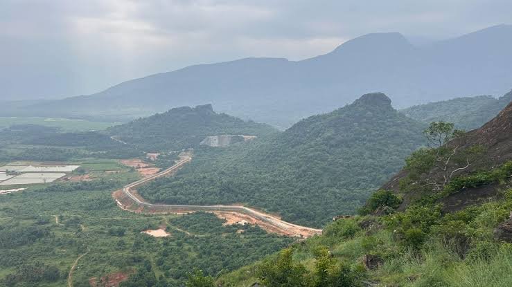
The Karnataka Legislature has rejected the 7th draft notification of the MoEFCC proposing 56,825.7 sq. km of the Western Ghats as Ecologically Sensitive Area (ESA). Karnataka, which has the largest proposed share (20,668 sq. km across 10 districts), has sought a one-year physical survey before final demarcation.
About the Western Ghats
- Location: A mountain range along India’s western coast, extending through six states—Gujarat, Maharashtra, Goa, Karnataka, Kerala and Tamil Nadu.
- Extent: About 1,600 km, meeting the Eastern Ghats at the Nilgiri Hills.
- Highest Peak: Anamudi (2,695 m) in Kerala.
- Important Gaps: Goa Gap, Palakkad Gap and Shencottah Gap.
- Ecological Importance: A UNESCO World Heritage Site and one of the world’s major biodiversity hotspots, influencing the Southwest Monsoon and supporting several peninsular rivers.
Kasturirangan Committee and ESA Proposal
- The High Level Working Group (HLWG), headed by K. Kasturirangan, was formed in 2012 to review the Madhav Gadgil-led Western Ghats Ecology Expert Panel (WGEEP).
- Its 2013 report recommended declaring 59,940 sq. km (about 37%) of the Western Ghats as Ecologically Sensitive Area (ESA), focusing on biologically rich natural landscapes with relatively low human pressure.
- The approach was less restrictive than the Gadgil framework, seeking to balance ecological conservation with development.
- The latest draft notification proposes 56,825.7 sq. km of ESA across the six Western Ghats states.
Gadgil vs Kasturirangan
| Gadgil Committee (2011) | Kasturirangan Committee (2013) |
| Proposed a broader conservation framework. | Proposed a more selective approach. |
| Emphasised ecological protection across the Western Ghats. | Focused on biologically rich natural landscapes. |
| Gave greater emphasis to local participation and decentralised decision-making. | Sought to balance conservation with development. |
Key Restrictions Under the ESA Proposal
- Prohibited: Mining, quarrying, sand extraction, red-category industries, thermal power plants, and township/area-development projects.
- Large construction: Buildings exceeding 20,000 sq. m would not be permitted.
- Regulated: Infrastructure and hydroelectric projects may be allowed subject to environmental clearances and specified conditions.
- ESA notification therefore restricts specific high-impact activities rather than banning all development.
Why Is Karnataka Opposing the ESA Proposal?
- Narrower coverage: Karnataka wants the ESA to cover mainly forest areas, excluding plantations, agricultural land and settlements.
- Ground verification: It wants physical surveys to verify boundaries instead of relying mainly on satellite-based mapping.
- Village inclusion: The state opposes including an entire village when only part of its area is forest.
- Livelihood concerns: ESA restrictions may affect farmers, plantation workers and local communities.
- Land and legal disputes: Karnataka has sought clarity on forest and revenue land, deemed forests, land grants, Forest Rights Act claims and Bagair Hukum cases.
- Development concerns: It wants restrictions to be designed without adversely affecting essential infrastructure and legitimate economic activities.
Significance of ESA Protection
- Biodiversity: Protects the Western Ghats’ endemic and threatened species and fragile ecosystems.
- Water security: Safeguards the source regions of major peninsular rivers, supporting agriculture and drinking water.
- Disaster resilience: Conserved forests help reduce soil erosion and landslide vulnerability.
- Climate regulation: Forests act as carbon sinks and help maintain the regional water cycle.
- Livelihoods: Forests, wetlands and grasslands provide soil, water and other ecosystem services that support local communities.
Way Forward
- Accurate Demarcation: Combine satellite mapping with physical verification and plot-level classification of forests, plantations, farms and settlements.
- Community Participation: Involve Gram Sabhas, local communities and tribal groups in ESA identification and implementation.
- Livelihood Protection: Provide alternatives and support to communities affected by conservation restrictions.
- Sustainable Development: Permit essential infrastructure after strict environmental assessment, while preventing irreversible ecological damage.
- Centre–State Coordination: Resolve boundary and land-use disputes through consultation, balancing ecological security with legitimate development needs.
FAQs
Q1. What is an Ecologically Sensitive Area (ESA)?
Ans: An ESA is an ecologically fragile area notified under the Environment (Protection) Act, 1986, where harmful activities are regulated or prohibited to protect ecosystems and biodiversity.
Q2. Does ESA notification ban all development activities?
Ans: No, it restricts specified high-impact activities while allowing certain infrastructure projects subject to environmental clearances and conditions.
Q3. How does the Western Ghats influence India’s climate?
Ans: The Western Ghats influence the Southwest Monsoon and help regulate the water cycle and rainfall over peninsular India.
Q4. How are the Gadgil and Kasturirangan approaches different?
Ans: Gadgil favoured broader protection and local participation, while Kasturirangan focused on selected natural landscapes and development needs.