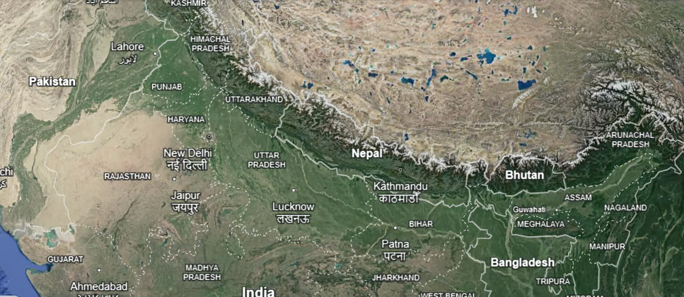
The Himalayas, a name derived from the Sanskrit words ‘Him’ (snow) and ‘Alaya’ (abode), represent the most formidable and youngest mountain system on Earth. Extending as a majestic arc for over 2,400 km, they separate the Indian subcontinent from the vast Tibetan Plateau. As one of India’s five primary physiographic divisions, the Himalayas are not merely a geographical feature but the “Crown of India,” influencing the nation’s climate, security, and spiritual identity.
1 The Geological Genesis: How the Himalayas Were Formed
The formation of the Himalayas is an example of Plate Tectonics and continental collision. Their birth is a result of the immense pressure generated by the convergence of two massive landmasses.
The Pre-Historic Landscape
- Pangea and Tethys: Roughly 250 million years ago, the Earth’s landmass was a single supercontinent called Pangea, surrounded by the Panthalassa ocean.
- The Great Split: About 150 million years ago, Pangea fractured into two parts: Laurasia (Angaraland) in the North and Gondwanaland in the South. The Tethys Sea emerged in the gap between them.
The Collision of Giants
- Northward Drift: Driven by mantle convection currents, the Indo-Australian Plate (detached from Gondwanaland) drifted northward at a high velocity toward the Eurasian Plate (Angaraland).
- The Folds of Tethys: As the plates converged, the Tethys Sea began to shrink. The immense compressive force squeezed the seabed sediments, causing them to buckle and rise into massive folds.
- Continuous Growth: The collision continues to this day. Because the Indo-Australian plate is still pushing northward, the Himalayas are rising by approximately 5 mm per year, making them geologically “active” and prone to earthquakes.
2 Classification and Types of the Himalayan Ranges
The Himalayas are not a single range but a series of parallel and converging ranges. They are broadly classified into four longitudinal belts based on their age and altitude.
1. The Trans-Himalayas (Tethys Himalayas)
Located immediately north of the Great Himalayas, this region is characterized by arid, high-altitude plateaus.
- Extent: Stretches about 1,000 km with an average elevation of 3,000 meters.
- Key Ranges: Karakoram: Known as the “Backbone of High Asia,” it houses K2 (Mount Godwin-Austen), the world’s second-highest peak (8,611m), and the Siachen Glacier.
- Ladakh Range: Situated between the Indus and Shyok rivers.
- Zaskar Range: Runs parallel to the Great Himalayas; its highest point is Kamet Peak.
2. The Greater Himalayas (Himadri)
This is the most continuous, highest, and oldest range of the Himalayas.
- Composition: Primarily made of Archaean rocks like granite and gneiss.
- Peaks: It contains the world’s highest peaks, including Mount Everest (Nepal), Kanchenjunga (India), and Nanga Parbat.
- Features: The northern slopes are gentle toward Tibet, while the southern slopes are extremely steep toward the Indian plains.
3. The Middle Himalayas (Lesser Himalayas/Himachal)
Located between the Himadri and the Shiwaliks, this range is famous for its rugged terrain and beautiful valleys.
- Elevation: 3,500 to 5,000 meters.
- Major Ranges: Pir Panjal (the longest range), Dhauladhar, and Mussoorie.
- Hill Stations: Home to Shimla, Nainital, Almora, and Ranikhet. It also contains Karewas—thick deposits of glacial clay and other materials useful for saffron cultivation.
4. The Outer Himalayas (Shiwalik Hills)
The youngest and southernmost part of the Himalayas, bordering the Indo-Gangetic plains.
- Formation: Composed of unconsolidated sediments brought down by rivers.
- Doons and Duars: The longitudinal valleys between the Lesser Himalayas and the Shiwaliks are called Doons in the west (e.g., Dehradun) and Duars in the east. They are highly fertile and vital for tea cultivation.
3 The Eastern Hills: Purvanchal
At the Dihang Gorge, the Himalayas take a sharp southward “Syntaxial Bend,” forming the Purvanchal hills along India’s border with Myanmar.
- Patkai Bum: Boundary between Arunachal Pradesh and Myanmar.
- Naga Hills: Forms the watershed between India and Myanmar.
- Mizo Hills (Lushai Hills): The southernmost part of this chain.
4 Strategic and Economic Significance of the Himalayas
| Category | Significance |
| Climatic Influence | Blocks freezing Siberian winds from entering India and intercepts the Southwest Monsoon, causing rainfall. |
| Natural Defense | Historically acted as an impenetrable wall protecting India from northern invasions. |
| Perennial Rivers | Source of the Indus, Ganga, and Brahmaputra, which sustain agriculture for millions. |
| Hydroelectric Power | Fast-flowing rivers and steep gradients offer massive potential for clean energy. |
| Forest & Minerals | Rich in timber, medicinal herbs, and minerals like copper, zinc, and precious gemstones. |
| Tourism | A global hub for pilgrimage (Char Dham) and adventure sports. |
5 Ecological Challenges and the Way Forward
Despite their majesty, the Himalayas are highly fragile. Climate change is causing rapid glacial retreat, threatening water security. Furthermore, unregulated tourism, deforestation, and infrastructure projects in seismic zones have increased the frequency of landslides and floods. A “Sustainable Himalayan Development” model is the only way to ensure this vital ecosystem remains balanced for future generations.
FAQs
HOW WERE THE HIMALAYAS FORMED?
The Himalayas were formed by the collision of the Indo-Australian Plate with the Eurasian Plate. This convergence compressed the sediments of the ancient Tethys Sea, pushing them upward to create “Fold Mountains.”
WHICH IS THE HIGHEST PEAK IN THE HIMALAYAS LOCATED IN INDIA?
Kanchenjunga, located on the border between Sikkim (India) and Nepal, is the highest peak in the Himalayas within Indian territory.
WHAT IS THE DIFFERENCE BETWEEN DOONS AND DUARS?
Doons (like Dehradun) are longitudinal valleys found in the Western Himalayas, while Duars are the floodplains and valleys in the Eastern Himalayas (Sikkim and West Bengal), often used for tea gardens.
WHICH RANGE IS KNOWN AS THE HIMADRI?
The Greater Himalayas are known as the Himadri. It is the most northern and highest range, remaining covered in snow throughout the year.
WHAT ARE THE TRANS-HIMALAYAN RANGES FOUND IN INDIA?
The major Trans-Himalayan ranges in India include the Karakoram, Ladakh, and Zaskar ranges.
WHICH PEAK IS KNOWN AS K2 AND WHERE IS IT LOCATED?
K2, also known as Mount Godwin-Austen, is the second-highest peak in the world. It is located in the Karakoram Range.
WHAT IS THE SYNTAXIAL BEND OF THE HIMALAYAS?
It is the sharp southward turn that the Himalayan ranges take at their eastern and western extremities (specifically at the Dihang Gorge in the east).
WHICH VALLEYS ARE FAMOUS FOR KAREWA FORMATIONS?
The Kashmir Valley, situated between the Pir Panjal and the Zaskar Range, is famous for Karewa formations, which are essential for growing Zafran (saffron).
HOW DO THE HIMALAYAS PROTECT INDIA CLIMATICALLY?
They act as a climatic divide by preventing the cold, dry winds of Central Asia from entering India and by trapping the moisture-laden monsoon winds to provide rain.
WHICH IS THE YOUNGEST RANGE OF THE HIMALAYAS?
The Shiwalik Hills (Outer Himalayas) are the youngest and the lowest-altitude range of the Himalayan system.