1. Panama
Context
Recently, India and Panama held bilateral talks to strengthen cooperation in maritime security, logistics, skill development, and digital transformation.
About Panama
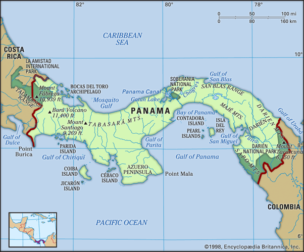
Location and Boundaries
- Panama is a Central American country located on the Isthmus of Panama, linking North and South America.
- It shares borders with Costa Rica (west) and Colombia (southeast), and is bounded by the Caribbean Sea to the north and the Pacific Ocean to the south.
- Panama City is the capital and largest city.
Physical Features
- The Cordillera Central forms the country’s principal mountain range.
- Lake Gatun which is an artificial lake, is integral to the operation of the Panama Canal.
- The Tuira River is the longest river in Panama.
- Panama has a predominantly tropical climate, while the highlands experience subtropical conditions.
Natural Resources
- Major mineral resources include gold, copper, manganese, and iron.
Strategic Significance
- Its location between the Atlantic and Pacific Oceans makes Panama a key hub for global maritime trade and international shipping.
2. Japan
Context
Recently, a powerful earthquake struck Kumamoto in southern Japan, claiming 13 lives and highlighting the country’s vulnerability to seismic activity.
About Japan
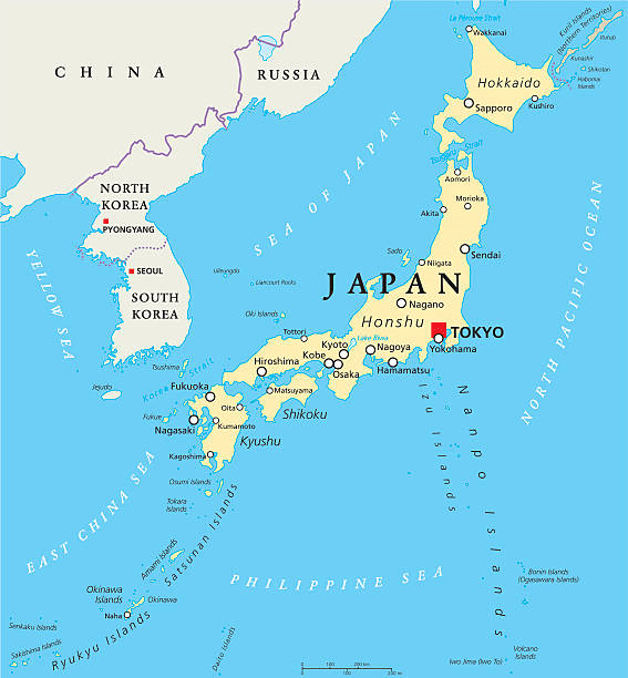
Location and Boundaries
- Japan is an island nation in East Asia, located in the northwestern Pacific Ocean.
- It is bounded by the Sea of Okhotsk (north), the Pacific Ocean (east), the Sea of Japan (west), and the East China Sea (southwest).
- Tokyo is the capital and largest city.
Physical Features
- Japan is an archipelago extending about 1,500 miles (2,400 km) from northeast to southwest.
- Its four main islands are Hokkaido, Honshu, Shikoku, and Kyushu.
- More than 80% of the country is mountainous, with the Japanese Alps forming the principal mountain system.
- Mount Fuji (3,776 m) is the country’s highest peak and an active stratovolcano.
Climate
- Japan has a predominantly temperate climate, ranging from the Laurentian (cool temperate eastern margin) climate in the north to humid subtropical climate in the south.
Geological and Oceanographic Significance
- Japan lies on the Pacific Ring of Fire, making it highly prone to earthquakes and volcanic eruptions.
- The convergence of the warm Kuroshio Current and the cold Oyashio Current off its eastern coast creates rich fishing grounds, making Japan one of the world’s leading fishing nations.
Major Rivers
- The Shinano River is the longest river, while the Tone and Kiso are other major rivers.
Natural Resources
- Major mineral resources include coal, iron ore, copper, zinc, lead, sulfur, gold, and silver.