- Courses
- GS Full Course 1 Year
- GS Full Course 2 Year
- GS Full Course 3 Year
- GS Full Course Till Selection
- MEP (Mains Enrichment Programme) Data, Facts
- Essay Target – 150+ Marks
- Online Program
- GS Recorded Course
- NCERT- First Ladder
- Polity
- Geography
- Economy
- Ancient, Medieval and Art & Culture AMAC
- Modern India, Post Independence & World History
- Environment
- Governance
- Science & Technology
- International Relations and Internal Security
- Disaster Management
- Ethics
- Current Affairs
- Indian Society and Social Issue
- CSAT
- 5 LAYERED ARJUNA Mentorship
- Public Administration Optional
- ABOUT US
- OUR TOPPERS
- TEST SERIES
- FREE STUDY MATERIAL
- VIDEOS
- CONTACT US
World’s Highest Chenab Railway Bridge Inaugurated
World’s Highest Chenab Railway Bridge Inaugurated
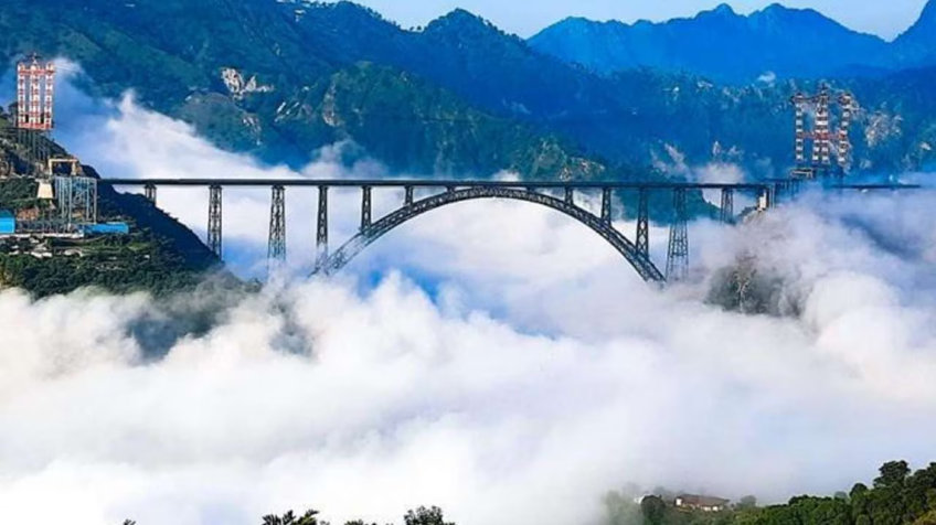
- In June 2025 Prime Minister of India inaugurated the world’s highest Chenab Rail Bridge in Reasi district, Jammu & Kashmir.
- Earlier, the Union Government has also confirmed that the Salal-Haimana area in Jammu and Kashmir’s Reasi district holds significant resources of lithium and titanium.
- It is a railway arch bridge.
- Its completion, particularly following events like "Operation Sindoor" in May 2025, highlights India's commitment to development and connectivity in Jammu & Kashmir amidst security challenges.
Geographical Relevance:
- Location:
- Spans the Chenab River in the Reasi district of Jammu & Kashmir.
- Connects Bakkal and Kauri villages, crossing a deep gorge.
- Geography:
- Altitude: Stands at 359 meters (1,178 feet) above the river, making it 35 meters taller than the Eiffel Tower (Paris, 324 meters).
- Terrain: Located in the Himalayas, characterized by ruggedness, steep mountain slopes, and a challenging landscape.
- The Chenab River Gorge is one of the deepest in the region.
- A gorge is a deep channel formed by a river that has eroded the earth's crust over millions of years.
- Some gorges are so large they are visible from space.
- One of the most famous is the Grand Canyon.
- Climate and Terrain Challenges:
- Experiences extreme weather conditions (temperatures from -20°C to 40°C).
- Prone to landslides, earthquakes (Seismic Zones IV/V), and harsh winters.
- Required carving 26 km of access roads and digging tunnels to reach the remote construction site.
- Strategic Importance (Geographical):
- Offers an all-weather rail link to the Kashmir Valley, which is frequently cut off during winter.
- Provides an alternative to the often-disrupted Jammu–Srinagar highway.
What is Seismic Zones IV and V: What Do They Mean?
Example: India’s Seismic Zoning:In India, the Bureau of Indian Standards divides the country into seismic zones I to V:
Buildings in Zones IV and V need to follow stricter codes to ensure safety against potential earthquakes. |
Technical and Structural Features:
- World’s Highest Railway Bridge: Its deck is 359 meters above the Chenab River, necessary to clear the deep gorge and ensure floodwater clearance. Project began in 2004, completed in 2022.
- Length and Arch Span:
- Total Length: 1,315 meters (1.315 km).
- Arch Span: 467 meters (1,532 feet) steel arch, one of the longest constructed globally.
- Resilience Features:
- Wind Resistance: Engineered to withstand wind speeds up to 260-266 km/h, aerodynamic studies ensured stability.
- Lifespan and Maintenance:
- Design Life: 120 years.
- Monitoring: Continuous monitoring via an advanced health monitoring system.
- Maintenance Access: Includes elevators inside piers and walkways.
- Global Collaboration:
- Lead: Konkan Railway Corporation Ltd.
- Construction: Joint venture of Afcons Infrastructure, VSL India, and Ultra Construction (South Korea).
Strategic and Infrastructure Importance
The bridge holds immense strategic and socio-economic significance beyond its engineering prowess.
- Udhampur–Srinagar–Baramulla Railway Link (USBRL):
- The bridge is a key part of the USBRL project, which will connect Jammu & Kashmir to the Indian Railways network.
- The USBRL spans 272 km, with 36 tunnels and 943 bridges.
- The Chenab Bridge specifically connects Katra (in Jammu) to Banihal (in the Kashmir Valley).
- National Integration:
- Provides all-weather connectivity to the Kashmir Valley, reducing isolation.
- Reduces travel time between Katra and Srinagar to just 3 hours (from 6-8 hours by road).
- National Security and Strategic Logistics:
- Enhances military logistics, enabling rapid movement of troops and supplies to Jammu & Kashmir.
- Crucial for faster relief operations and troop deployments during emergencies (natural disasters or conflicts).
- Economic Development:
- Promotes trade and tourism in Jammu & Kashmir.
- Facilitates transportation of horticultural products (apples, saffron) and handicrafts to national markets.
- The bridge itself is expected to become a major tourist attraction.
- Socio-Economic Benefits:
- Better Connectivity: Enhances locals' access to education, healthcare, and employment in Jammu and Srinagar.
- Job Creation: Significant local employment generated during construction and operation.
- Tourism Boost: Revitalizes the local economy through hospitality services.
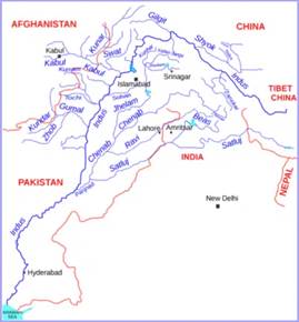
About Chenab River:
|
ENSURE IAS Prelims Questions:Q: Consider the following statements regarding the Chenab Rail Bridge:
Which of the above statements are correct? Answer: B Explanation:
|
ENSURE IAS Mains Question :Q: The inauguration of the Chenab Rail Bridge in Jammu & Kashmir marks a significant progress in India’s infrastructure development and strategic connectivity. Discuss the strategic, socio-economic, and engineering challenges involved in constructing the Chenab Rail Bridge, and analyze its potential impact on the region’s integration, security, and economic development. (250 Words) |
Delays And Problems Are Hurting Ayushman Bharat In Jharkhand
CAG Conducts First Audit of Jal Jeevan Mission
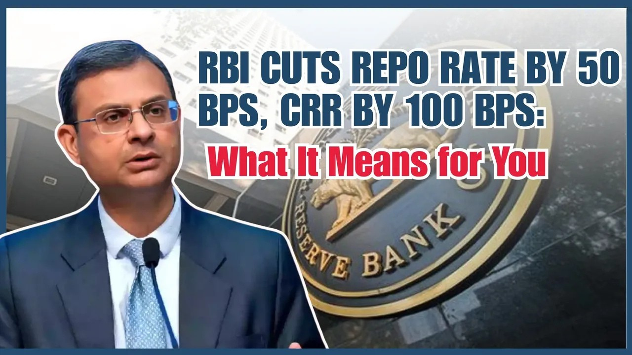
RBI Cuts Repo Rates by 50 bps: Monetary Policy Move
Karol Bagh Metro Pillar No. 112, Above Domino's, 22B, First Floor, New Delhi - 110060
Very Important Instruction For Any Issue, Student Must Produce His/Her Fee Receipt. Without Fee Receipt, It Will Not Be Possible To Track Your Details. If You Have Been Given Any Special Consideration, You Must Keep That In Writing And Produce In Case Of Conflict.
Copyright © 2024-2026 ENSURE IAS. All rights reserved.