Why in the News?
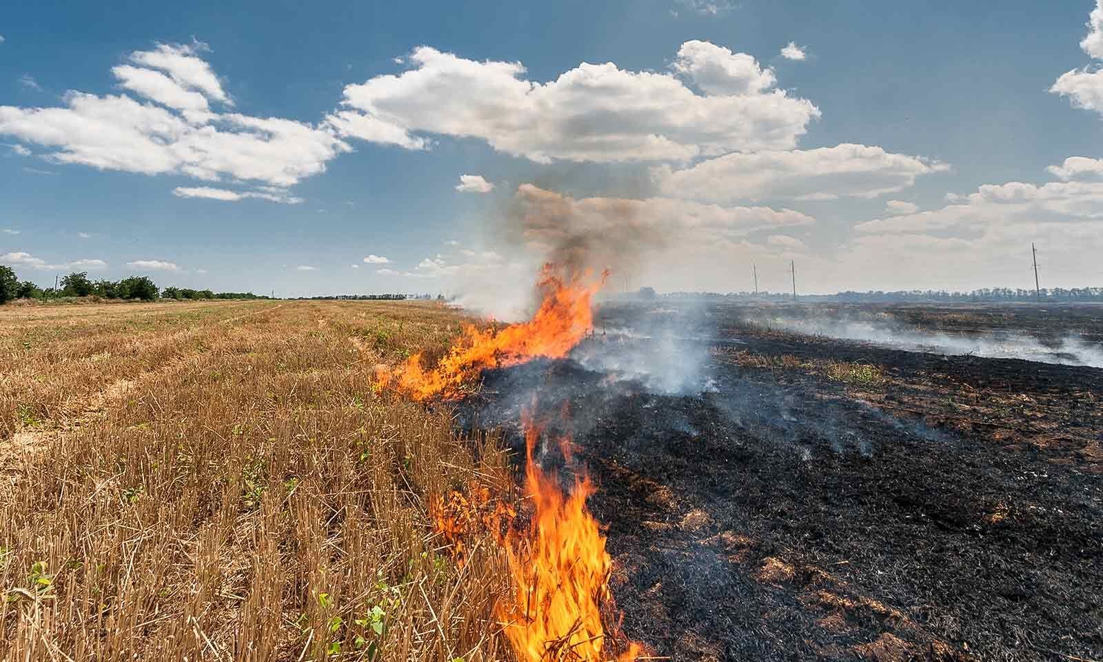
- Paddy harvesting in Punjab has increased and stubble burning remains a seasonal problem that worsens air pollution in North India.
- Official counts report a drop in fire incidents, but satellite and ground evidence show the burnt area remains large, raising questions about monitoring and emissions.
- New studies highlight limitations of satellite detection and call for integrated monitoring and ground verification to estimate real emissions.
Key Highlights
- Harvesting and the stubble problem
- After harvest, paddy stubble remains on fields because combine harvesters cut the grain and leave the stalks behind.
- Farmers need fields ready quickly for the next crop, usually wheat, and the short window (about three weeks) creates pressure.
- Because burning is fast and cheap, many farmers choose stubble burning to clear fields for sowing.
- Government action and reported decline in fire counts
- Governments have used enforcement, subsidies for machinery, and awareness drives to reduce burning.
- Official satellite-aggregated data from Punjab showed a sharp fall in fire counts in 2024 compared to 2023.
- Authorities have cited this decline as a sign of policy success in curbing farm fires.
- Evidence that the burnt area stayed high
- Despite fewer counted fires, satellite-derived estimates of burnt area for paddy residue in 2024 remained similar to 2023 and higher than 2021–22.
- This suggests that counting fire events alone may not capture the full extent of residue burning on the ground.
- Farmers’ responses to floods and local cropping changes also influenced the pattern of burns.
- Why do thermal sensor data and optical sensor data differ?
- Thermal sensors (which count active fires) can miss many small, short, or low-intensity burns common in fragmented farm plots.
- Optical sensors detect post-fire burn scars (burnt-area estimates) but are hindered by clouds, haze or smoke.
- Satellite overpass timing, farmer behaviour (e.g., hiding burns), and sensor sensitivity together cause discrepancies between fire counts and burnt-area estimates.
- From area to emissions: intensity matters
- The pollution released depends on fire intensity, fuel load (amount of residue), and duration, not just on the total area burnt.
- Many recent burns are low-intensity and short-duration, which may emit less particulate matter per hectare than large, high-intensity fires.
- Accurate emissions assessment needs integrated remote sensing, field measurements, and models that use intensity and fuel data.
Key Terms
- Stubble burning
- Stubble burning is the deliberate ignition of leftover crop residues after harvest to clear fields quickly.
- Farmers often prefer burning because it is the fastest and cheapest method for preparing land for the next crop.
- Burning produces particulate matter (PM2.5/PM10) and gaseous pollutants that harm health and visibility.
- Repeated burning depletes soil organic matter and can reduce long-term soil fertility.
- Alternatives include in-situ management (using Happy Seeder), mulching, baling, composting, and converting residue to bioenergy.
- Effective policy must combine incentives, technology access, and market solutions for residue use.
- Fire intensity and fuel load
- Fire intensity measures the energy release during combustion and affects pollutant production and soil impact.
- Fuel load is the quantity of combustible material per unit area, such as tonnes of straw per hectare.
- High fuel load and high intensity produce more emissions than low-intensity burns on the same area.
- Duration of burning also influences total emissions and transformation of biomass.
- Emission inventories must use intensity and fuel data, not area alone, to estimate pollution.
- Happy Seeder and residue-management technology
- The Happy Seeder is a machine that allows sowing of wheat directly into paddy stubble without removing residue.
- It chops and spreads residue, allowing immediate sowing and conserving soil moisture.
- High purchase costs and logistics limit farmer adoption without subsidies or custom-hire services.
- Other technologies include balers, straw choppers, and machines that convert residue into pellets or compost.
- Scaling such technologies requires local service markets, training and well-designed incentives.
- Ground-truthing (validation)
- Ground-truthing means verifying satellite observations through field visits and measurements.
- It helps distinguish partial burns from full burns and estimates fuel load and intensity.
- Ground data improve the calibration of satellite algorithms and emissions models.
- Regular ground surveys also provide socio-economic context, revealing why farmers burn.
- Effective monitoring systems combine remote sensing, ground-truthing and community reporting.
Implications
- Policy must target emissions, not just burnt area, to protect air quality effectively.
- Monitoring systems should combine thermal and optical satellites with routine ground verification for reliable data.
- Farmer support—affordable machinery, custom-hire services, and incentives—remains essential to reduce burning.
- Enforcement needs evidence; validated data will help avoid wrongful penalties and focus action on true hotspots.
- Health advisories and mitigation must be based on emissions estimates and local meteorology to protect public health.
Challenges and Way Forward
| Challenge | Way Forward |
| Satellite detection gaps | Use integrated monitoring by combining thermal and optical satellites, increase sensor revisit rates, and incorporate higher-resolution data. |
| Lack of systematic ground validation | Create a network for ground-truthing with periodic field surveys and local reporting to validate satellite observations. |
| Farmer dependence on burning | Scale up access to residue-management machines (Happy Seeder, balers), promote custom-hire centres, and offer targeted subsidies. |
| Short sowing window logistics | Improve rural logistics, provide timely machinery, and coordinate sowing calendars to reduce time pressure on farmers. |
| Policy focus on counts rather than emissions | Shift to emissions-based targets, develop emission factors for crop residue, and adopt intensity-aware monitoring and modelling. |
Conclusion
Stubble burning in Punjab is a socio-technical problem that combines farmer economics, crop calendars, and technical limits of monitoring. A reliable solution requires better data (integrated satellites + ground verification), farmer-friendly technologies and services, and policy redesign that targets emissions and supports farmers rather than punishing them. Only a coordinated scientific, economic and social strategy will reduce pollution sustainably.
| EnsureIAS Mains Question
Q. Analyse the limitations of remote sensing for monitoring agricultural residue burning. Suggest an integrated policy framework India should adopt to reduce stubble burning and associated air pollution. (250 words) |
| EnsureIAS Prelims Question
Q. Consider the following statements: 1. Thermal satellite sensors alone provide a complete and accurate estimate of total area burnt by agricultural fires. 2. Fire emissions depend on fire intensity, fuel load and duration, and not merely on the burnt area. Which of the statements given above is/are correct? Answer: B Explanation: Statement 1 is incorrect: Thermal satellites detect active fires by heat, but they can miss small, short-duration or low-intensity burns and are affected by overpass timing, clouds and smoke. Therefore, thermal sensors alone do not give a complete burnt-area estimate. Statement 2 is correct: Emissions depend on fire intensity, the amount of fuel (residue) available and how long the fire burns. Two areas with the same burned hectare can produce different emissions if the fires vary in intensity or duration. Emissions assessment must therefore include these variables. |