

Context
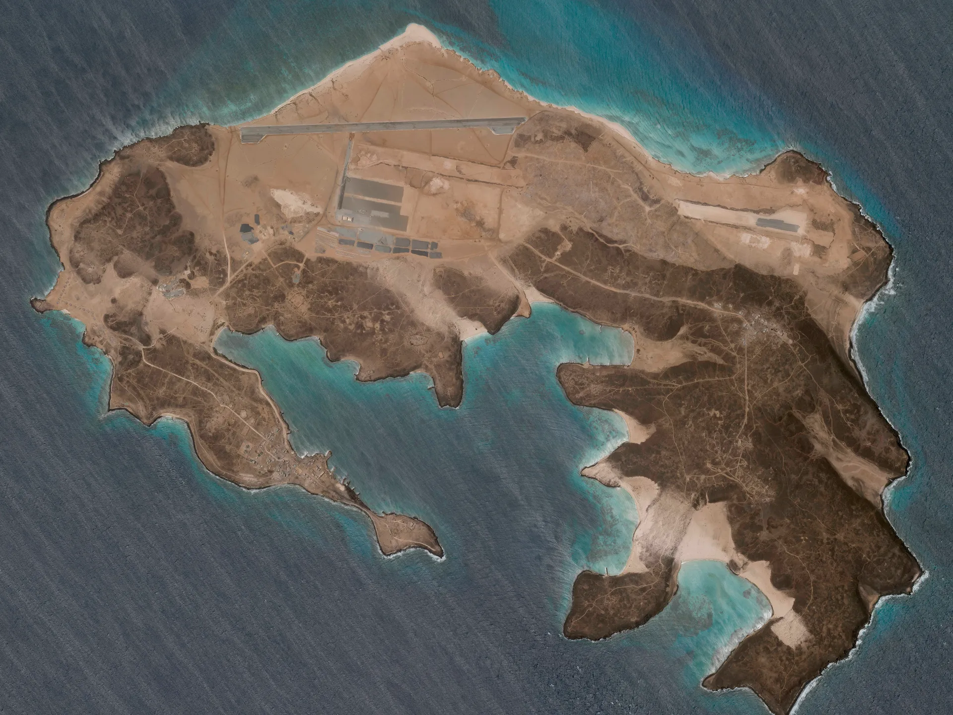
Mayun Island, a strategically located Yemeni island in the Bab el-Mandeb Strait, was recently reported to have been captured by Iranian-backed Houthi rebels, highlighting its importance for control over the Red Sea’s maritime gateway.
About Mayun Island
- Historical Background
- The British occupied the island in 1857 and established a coaling station to support maritime traffic.
- The station eventually became unviable and was closed in 1935.
- Mayun remained under British control from 1857 to 1967.
- Following the end of British rule, the island became part of independent Yemen (Aden) in 1967.
- Location and Geography
- Mayun Island, also called Perim Island, is a small volcanic island belonging to Yemen.
- It lies in the Bab el-Mandeb Strait, which connects the Red Sea with the Gulf of Aden.
- It covers about 13 sq. km and rises to around 65 m above sea level.
- The island divides the strait into two channels and lies close to its narrowest section, which is about 26 km wide.
- Strategic Importance
- Its importance increased after the opening of the Suez Canal, which created a shorter maritime connection between the Mediterranean Sea and the Indian Ocean via the Red Sea, avoiding the longer route around Africa.
- Since Mayun lies within the Bab el-Mandeb, control over the island provides an advantage over the eastern channel and influence over the western channel.
- It has a natural deep-water harbour on its southwestern side and a military airfield in the north.
Conclusion
Despite its small size, Mayun’s location at the Bab el-Mandeb chokepoint gives it considerable strategic importance for Red Sea security and global maritime trade.
FAQs
Q1. Where is Mayun Island located?
It lies in the Bab el‑Mandeb Strait, connecting the Red Sea with the Gulf of Aden.
Q2. What is the historical background of Mayun Island?
Occupied by the British in 1857, used as a coaling station until 1935, and remained under British control until 1967 before becoming part of Yemen.
Q3. Why is Mayun Island strategically important?
Its position at the Bab el‑Mandeb chokepoint allows control over maritime traffic between the Mediterranean and Indian Ocean via the Suez Canal route.
Q4. What are the geographical features of Mayun Island?
A small volcanic island of about 13 sq. km, rising 65 m above sea level, dividing the strait into two channels.
Q5. What facilities exist on Mayun Island?
It has a natural deep‑water harbour on the southwest and a military airfield in the north.