- Courses
- GS Full Course 1 Year
- GS Full Course 2 Year
- GS Full Course 3 Year
- GS Full Course Till Selection
- Online Program
- GS Recorded Course
- NCERT (Recorded 500+ Hours)
- Polity Recorded Course
- Geography Recorded Course
- Economy Recorded Course
- AMAC Recorded Course
- Modern India, Post Independence & World History
- Environment Recoded Course
- Governance Recoded Course
- Science & Tech. Recoded Course
- International Relations and Internal Security Recorded Course
- Disaster Management Module Course
- Ethics Recoded Course
- Essay Recoded Course
- Current Affairs Recoded Course
- CSAT
- 5 LAYERED ARJUNA Mentorship
- Public Administration Optional
- ABOUT US
- OUR TOPPERS
- TEST SERIES
- FREE STUDY MATERIAL
- VIDEOS
- CONTACT US
PLACES IN NEWS 5th MAY 2025
PLACES IN NEWS 5th MAY 2025

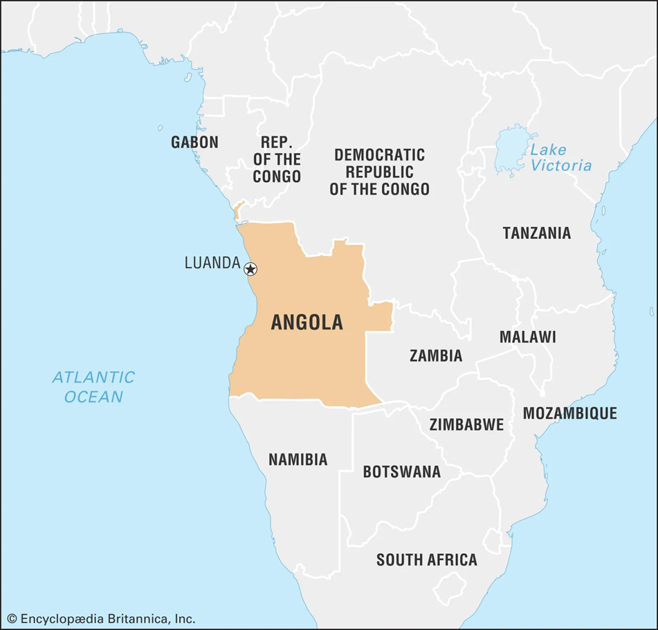
Angola
Why in news?
a. President Droupadi Murmu hosted Angolan President João Lourenço at Rashtrapati Bhavan, marking 40 years of India–Angola diplomatic ties.
About Angola:
- Geography and Location:
- Angola is located on the southwestern coast of Africa, bordered by Namibia to the south, the Democratic Republic of Congo to the north, Zambia to the east, and the Atlantic Ocean to the west.
- The country features diverse geography—coastal plains, savannas, mountain ranges, and tropical forests—with the Cuanza River being one of its major rivers, playing a crucial role in agriculture and hydropower.
- The capital city, Luanda, situated along the Atlantic coast, serves as Angola’s primary port, economic centre, and gateway for international engagement.
- Potential Natural Resources:
- Angola is rich in natural resources, particularly crude oil and diamonds, which form the backbone of its economy, contributing over 90% of export revenues.
- The country also has significant deposits of iron ore, gold, phosphate, copper, and natural gas, with untapped potential in agriculture, fisheries, and renewable energy, especially solar and hydropower.
- Angola’s abundant arable land and biodiversity offer vast opportunities for
sustainable development, regional food security, and climate-resilient growth.
- India’s Ties with Angola:
- India and Angola established diplomatic relations in 1985, and the year 2025 marks their 40th anniversary, with growing cooperation in energy, trade, healthcare, and capacity building.
- India imports a substantial volume of crude oil from Angola, making it one of India's top African energy partners. In return, India exports pharmaceuticals, machinery, and agricultural products to Angola.
- India has extended Lines of Credit (LoCs) and implemented projects in agriculture, IT, and health sectors, with regular high-level visits and training programs under the Indian Technical and Economic Cooperation (ITEC).
- Angola’s Importance to India:
- Angola holds strategic importance as part of India’s Africa outreach policy, especially under the India-Africa Forum Summit (IAFS) framework, focusing on mutual development.
- Angola’s energy resources support India’s energy security, while its market offers avenues for Indian investment and technology transfer, especially in infrastructure and mining.
- Strengthening ties with Angola helps India enhance its presence in Southern Africa, promoting South-South cooperation and balancing influence in the Global South geopolitics.
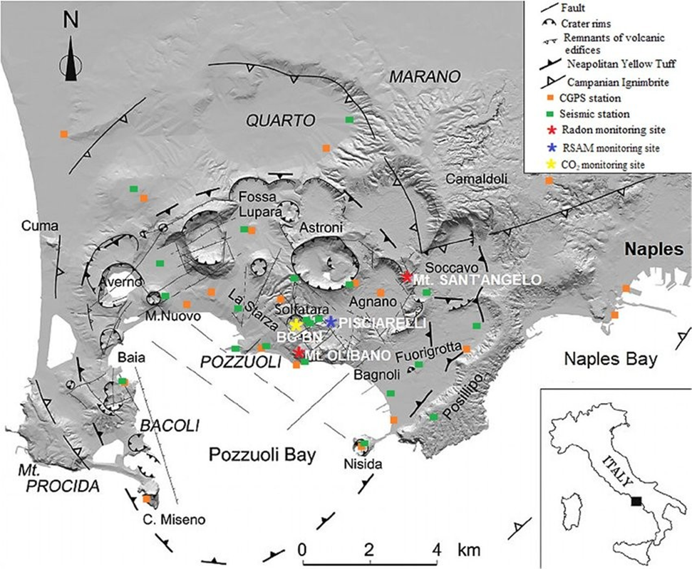
Campi Flegrei
Why in news?
a. Scientists observed repeated unrest at Campi Flegrei (1982–84, 2011–2024) with land uplift, quakes, and underground fluid-induced rumbling.
About Campi Flegrei:
- Location and Physical Characteristics:
- Campi Flegrei, also known as the Phlegraean Fields, is a vast volcanic caldera situated near Naples, Italy, partly extending beneath the Tyrrhenian Sea.
- Unlike a singular volcanic cone like Mount Vesuvius, Campi Flegrei is a volcanic system spread over a 12–15 km wide caldera, formed by a massive eruption nearly 39,000 years ago.
- This eruption had global climatic effects and is believed to have contributed to the
decline of Neanderthals, making the region scientifically significant.
- Reason Behind Repeated Unrest:
- Campi Flegrei is classified as a supervolcano, indicating the potential for large-scale eruptions with global impacts such as climate disruption and massive ash fallout.
- The region has shown cyclical unrest, most notably during 1982–1984 and 2011–2024, marked by bradyseism—a phenomenon involving ground uplift and subsidence caused by magma and gas movement underground.
- These episodes are accompanied by earthquakes, rumbling sounds, and increased seismic activity, all attributed to rising underground fluid pressure, signalling possible magma accumulation.
- The last eruption in 1538 formed Monte Nuovo, ending a 3,000-year dormancy and highlighting the need for continuous monitoring of this high-risk volcanic system.
Lairai Devi temple
Why in news?
a. A stampede during the Lairai Jatra at Shirgaon, North Goa, left six dead and over 70 injured early Saturday morning.
About Lairai Devi temple:
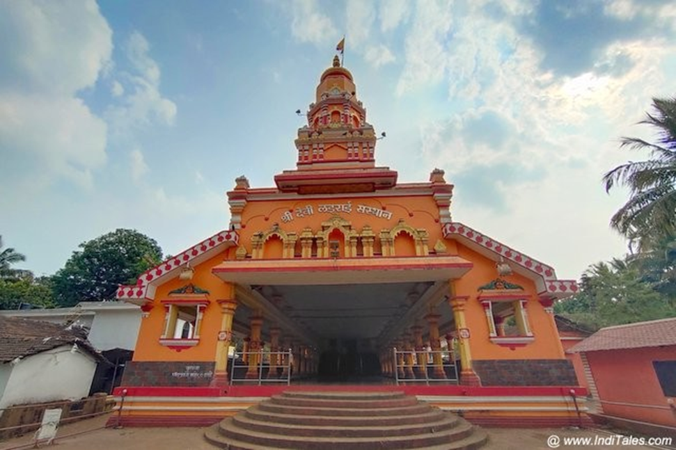
- Location and Physical Attributes:
- The Lairai Devi Temple is located in Shirgao village, Bicholim taluka, in
North Goa, nestled amidst the serene natural surroundings of the Western Ghats.
-
- The temple is built in traditional Goan architectural style, featuring intricate carvings, vibrant interiors, and a peaceful ambience that enhances its spiritual atmosphere.
- The site is easily accessible and serves as a prominent pilgrimage centre, drawing devotees from Goa, Maharashtra, and Karnataka.
- Cultural and Historical Significance:
- The temple is dedicated to Goddess Lairai, believed to be an incarnation of Goddess Parvati and one of the seven divine sisters of Goan folklore, alongside Khetoba, their brother.
- It is revered for its role in promoting religious harmony, with both Hindus and Catholics participating in its worship, often equating Lairai Devi with the Virgin Mary of Mapusa.
- The temple's most significant cultural event is the Lairai Jatra, also known as the
Shigmo Jatra, held annually in her honour.
- The Lairai Jatra Procession:
-
- The Jatra is renowned for the dramatic fire-walking ritual, or Agnidivya, performed by male devotees known as "dhonds", who prepare for days through fasting and prayer.
- The festival begins with devotional processions, dances, and drumming, followed by the lighting of a massive bonfire at midnight. In the early hours, dhonds walk barefoot across burning embers while chanting the goddess’s name.
- It is believed that only the righteous and devoted emerge unscathed, reaffirming their faith and purity, while the event strengthens community bonds and preserves Goan spiritual heritage.
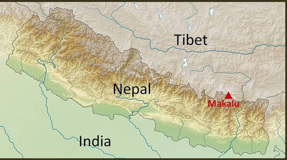
Mt. Makalu
Why in news?
a. The ITBP recently achieved a major feat by successfully scaling Mt. Makalu, the world’s fifth-highest peak near China.
About Mt. Makalu:
- Strategic Location and Physical Features:
-
- Mt. Makalu, standing at 8,485 meters (27,838 feet) above sea level, is the fifth-highest mountain in the world, located in the Mahalangur range of the Nepal Himalayas, near the Nepal-Tibet (China) border.
- It lies approximately 23 km southeast of Mount Everest, forming part of the trans-Himalayan frontier region, and falls within the Makalu Barun National Park, known for its pristine biodiversity.
- The mountain is uniquely shaped like a perfect pyramid with four sharp ridges, making it visually distinct and geographically prominent.
- Importance and Strategic Significance:
- Due to its location along the Nepal-China border, Mt. Makalu holds immense strategic importance for India’s security forces, especially in the context of border surveillance and high-altitude preparedness.
- The Barun Valley, located at the base of the mountain, is rich in flora, fauna, and ethnic cultures such as those of the Sherpa and Kirat communities, adding ecological and anthropological value to the region.
- Climbing Mt. Makalu is considered extremely challenging due to its steep pitches, knife-edged ridges, and technical summit pyramid, making it a vital training ground for elite mountaineering forces like the Indo-Tibetan Border Police (ITBP).
Bhakra dam
Why in news?
a. All political parties in Punjab unanimously opposed releasing any additional water from the Bhakra dam to Haryana, transcending party lines.
About Bhakra Dam:
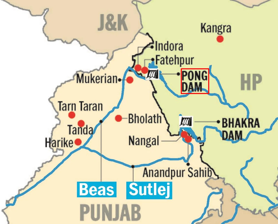
- Location and Physical Features:
- The Bhakra Dam is a concrete gravity dam constructed across the Sutlej River, located near the Bhakra village in Bilaspur district, Himachal Pradesh, close to the Punjab border.
- It stands at a height of 207.26 meters, making it the highest straight gravity dam in the world and Asia’s second-tallest dam after the Tehri Dam.
- The dam stretches 518.25 meters in length and creates the massive Gobind Sagar reservoir, which can store up to 9.34 billion cubic meters of water, making it India’s second-largest reservoir.
- Economic Importance:
- Constructed between 1948 and 1963, the dam was one of India’s first major post-independence infrastructure projects, hailed by Jawaharlal Nehru as the "New Temple of Resurgent India."
-
- The Bhakra Beas Management Board (BBMB) oversees its operation. The dam plays a crucial role in irrigation, hydropower generation, and flood control across Punjab, Haryana, Rajasthan, and Himachal Pradesh.
- It supports extensive canal irrigation systems and powers hydroelectric plants
that contribute significantly to the energy needs of North India.
- Issues and Recent Controversy:
- The dam has recently become a centre of inter-state water disputes, especially between Punjab and Haryana.
- Amid a severe water crisis, all political parties in Punjab have unanimously opposed the release of any additional water to Haryana from the Bhakra reservoir.
- Punjab argues that water levels are already critically low, and releasing more water would compromise the state’s irrigation needs, while Haryana continues to demand its legally mandated share, leading to political and legal tensions.

|
Also Read |
|
| FREE NIOS Books | |
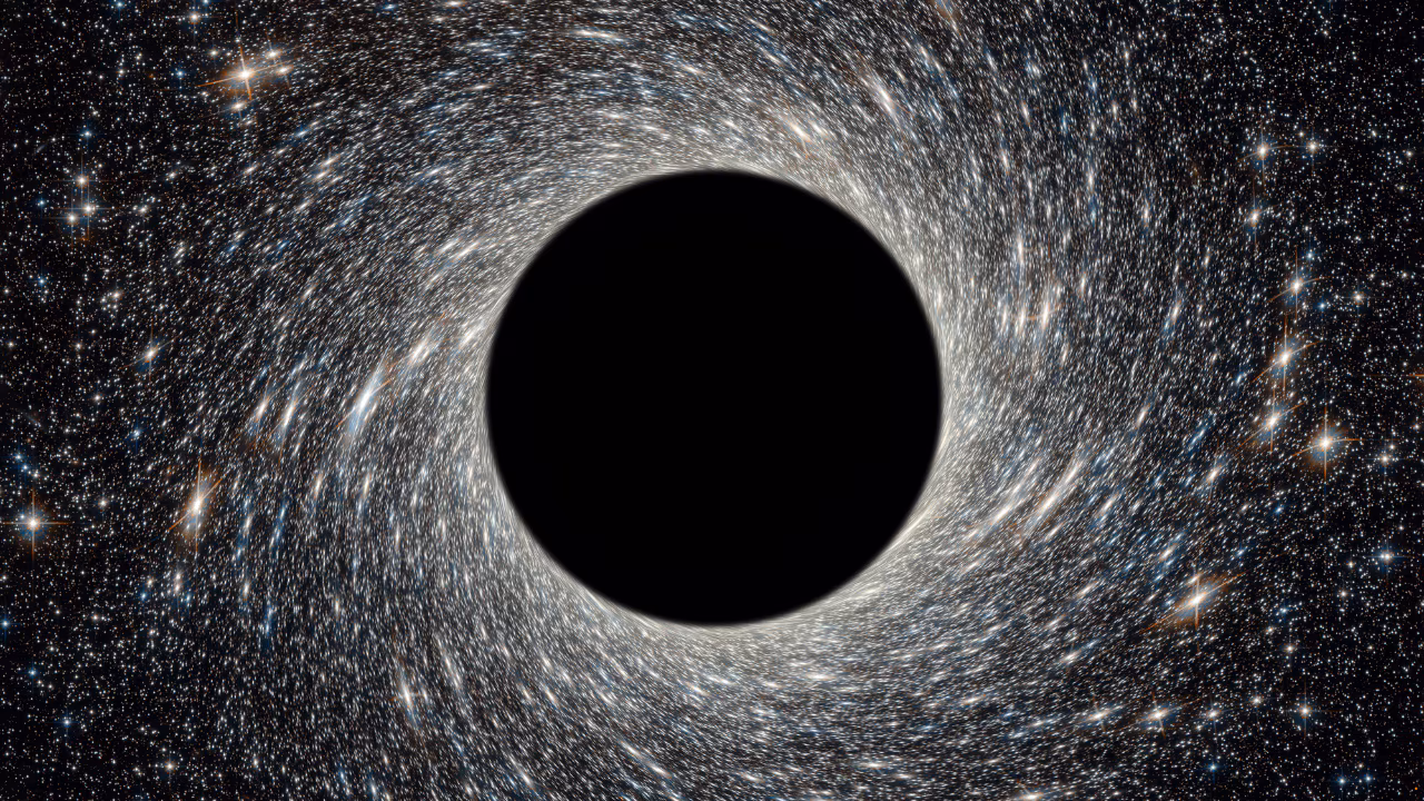
World's First 'Black Hole Bomb' Created in a Lab (2025)
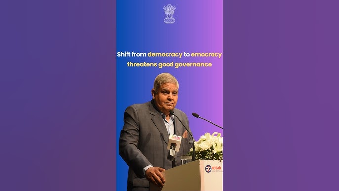
From Democracy to Emocracy: Understanding the Shift
PLACES IN NEWS 5th MAY 2025
Karol Bagh Metro Pillar No. 112, Above Domino's, 22B, First Floor, New Delhi - 110060
Copyright © 2024-2026 ENSURE IAS. All rights reserved.