- Courses
- GS Full Course 1 Year
- GS Full Course 2 Year
- GS Full Course 3 Year
- GS Full Course Till Selection
- Answer Alpha: Mains 2025 Mentorship
- MEP (Mains Enrichment Programme) Data, Facts
- Essay Target – 150+ Marks
- Online Program
- GS Recorded Course
- Polity
- Geography
- Economy
- Ancient, Medieval and Art & Culture AMAC
- Modern India, Post Independence & World History
- Environment
- Governance
- Science & Technology
- International Relations and Internal Security
- Disaster Management
- Ethics
- NCERT Current Affairs
- Indian Society and Social Issue
- NCERT- Science and Technology
- NCERT - Geography
- NCERT - Ancient History
- NCERT- World History
- NCERT Modern History
- CSAT
- 5 LAYERED ARJUNA Mentorship
- Public Administration Optional
- ABOUT US
- OUR TOPPERS
- TEST SERIES
- FREE STUDY MATERIAL
- VIDEOS
- CONTACT US
India is Expected To Receive Higher than Average Rainfall
India is Expected To Receive Higher than Average Rainfall
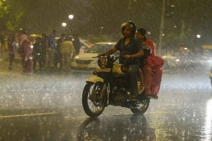
Why in the News?
- The India Meteorological Department (IMD) has said that monsoon rainfall in July will be above normal,
- It is expected that monsoon rainfall will be about 6% more than the usual rainfall of 28 cm.
- This is important because July is the most important month for farming in India.
- Some States may receive very heavy rainfall, and people need to be careful, especially near rivers.
|
Aspect |
Details |
|
Definition |
|
|
Types of Monsoon |
|
|
Factors Affecting Monsoon |
|
What are the Key Highlights of the Monsoon Forecast?
- Above Normal Rainfall in July:
- July, the most crucial month for agriculture, is expected to receive above-normal rainfall.
- IMD predicts around 6% more rainfall than the normal 28 cm for the month.
- Overall Monsoon (June–September):
- The India Meteorological Department (IMD) has maintained its earlier forecast of the monsoon being 6% above normal for the entire season.
- Regions of Concern:
- States likely to receive excess rain:
- East Madhya Pradesh, Chhattisgarh, Odisha, parts of Vidarbha, and Telangana.
- Watchlist due to surplus rain risks:
- Chhattisgarh, Odisha, and Telangana must remain alert.
- States likely to receive excess rain:
- Impact on River Basins:
- Heavy rainfall expected in major river catchments:
- Krishna, Godavari, and Mahanadi basins.
- Specific Concern Areas:
- Upper Mahanadi catchment in Chhattisgarh and parts of Odisha.
- Lower Mahanadi catchment is also expected to receive high rainfall.
- Heavy rainfall expected in major river catchments:
- Advisory by IMD:
- Authorities should monitor rainfall closely, especially in the river catchment areas, to prevent possible flooding or water management issues.
- Early Completion of Monsoon Coverage:
- On June 29, the monsoon covered the entire country, which is 9 days earlier than the usual date of July 8.
- This is only the 13th time since 1960 that full coverage occurred in June.
- In 6 out of those 12 previous instances, overall monsoon rainfall was above normal.
- Monsoon Onset and June Performance:
- Monsoon reached Kerala early, by about a week before the usual June 1 date.
- However, it stalled soon after onset, and resumed significantly only after June 16.
- June rainfall overall has been 8.9% above normal so far.
- Regional Rainfall Distribution (June):
- Northwest India: Received 42% more rain than normal.
- Central India: Received 24.8% more than normal.
- South India: Facing a rainfall deficit of about 3%.
- Eastern and Northeastern India: Lagging behind in rainfall.
- Cause of Strong Rainfall:
- The absence of El Niño is a key factor behind expected strong rainfall in the coming weeks.
- Forecast and Preparedness Advisory:
- Heavy rains are expected in July, especially over central India.
- IMD will continue to issue:
- Short-term forecasts
- Extended range forecasts (up to 2 weeks in advance)
- Precautionary measures are advised for all regions likely to be affected.
- IMD will continue to issue:
- Heavy rains are expected in July, especially over central India.
What are the Significances?
- Agricultural Benefits:
- Timely sowing: Early arrival and widespread coverage of monsoon enables farmers to begin sowing kharif crops (like paddy, pulses, and oilseeds) on time.
- Higher crop yields: Adequate and well-distributed rainfall improves soil moisture, leading to better crop growth and higher productivity.
- Reduced irrigation stress: Rain-fed regions will rely less on groundwater and irrigation infrastructure, conserving water resources.
- Economic Impact:
- Boost to rural economy: Good monsoon supports agricultural income, rural employment, and overall rural demand, which can boost consumption in the broader economy.
- Control on inflation: Healthy food grain production helps keep food prices stable, thereby reducing inflationary pressure.
- Improved GDP outlook: Agriculture contributes significantly to GDP and employment. A good monsoon positively affects the macroeconomic stability of the country.
- Water Resource Management:
- Refilling of reservoirs and aquifers: Surplus rainfall aids in replenishing dam reservoirs, groundwater tables, and rivers, ensuring better water availability for agriculture, drinking, and hydropower.
- Hydropower generation boost: Increased water flow in rivers and dams supports power generation, reducing dependence on fossil fuels.
- Disaster Preparedness and Challenges:
- Flood risk in vulnerable regions: Heavy rainfall in catchment areas (like Krishna, Godavari, and Mahanadi) increases the risk of flash floods and dam overflows.
- Need for preparedness: Early warnings and short-range forecasts from IMD allow better planning and disaster response, especially in high-rainfall zones like central and eastern India.
- Climatic Insight:
- Absence of El Niño conditions suggests a favorable climatic phase which generally supports better rainfall. This provides useful data for long-term climate planning and monsoon modelling.
- Policy Implications:
- Support to government schemes: Timely and good monsoon enhances the outcomes of schemes like PMFBY (crop insurance), PM-KISAN, and irrigation projects.
- Need for balanced regional planning: Regions like south India and northeast India with rainfall deficits may require additional support and contingency crop planning.
What are the Challenges and Way Forward?
|
Challenges |
Way Forward |
|
1. Flood Risk in River Basins: Excess rain in Krishna, Godavari, and Mahanadi catchments may cause flooding. |
Strengthen flood forecasting systems and ensure real-time monitoring of river flows. |
|
2. Regional Rainfall Imbalance: South and Northeast India face rainfall deficits. |
Promote contingency crop plans and ensure drought-resilient seeds and water management. |
|
3. Soil Erosion and Crop Damage: Heavy rains can damage young crops and erode fertile topsoil. |
Encourage soil conservation techniques and timely crop insurance coverage under PMFBY. |
|
4. Urban Flooding and Drainage Issues: Cities may witness water logging due to poor drainage infrastructure. |
Improve urban drainage systems and integrate climate-resilient urban planning. |
|
5. Water Management Imbalance: Uneven rainfall may lead to overfilling of some dams and dryness in others. |
Adopt basin-wise water management and promote interlinking of rivers where feasible. |
|
6. Pest and Disease Outbreaks: Warm, wet conditions can increase crop diseases and pests. |
Strengthen agricultural extension services and promote integrated pest management. |
Conclusion
The early and above-normal monsoon is a good sign for agriculture and water supply. However, it also brings risks of floods and excess water in rivers. Careful planning, monitoring, and timely action will help manage the situation well and support both farmers and the general public.
El Niño, La Niña and ENSOWhat is ENSO?ENSO stands for El Niño–Southern Oscillation. It is a natural climate pattern that occurs in the tropical Pacific Ocean. ENSO includes changes in ocean temperatures and atmospheric pressure, which affect global weather, especially the Indian monsoon. ENSO has three phases:
El Niño – Detailed Information
La Niña – Detailed Information
How the ENSO Cycle Works?
How is ENSO Monitored?
Effect of ENSO on Indian Monsoon
|
|
Ensure IAS Mains Question: Q. “The forecast of above-normal monsoon brings both opportunities and risks.”In this context, critically analyse the likely impact of this monsoon pattern on agriculture, economy, and disaster management. Suggest region-specific strategies to maximise benefits and minimise losses. (250 Words) |
Ensure IAS Prelim MCQ:MCQ 1: With reference to the Indian monsoon, consider the following statements:
How many of the above statements are correct? Answer: A Explanation: Statement 1 is correct: In 2025, the monsoon covered the entire country by June 29, 9 days early, which is rare (only the 13th time since 1960). Statement 2 is incorrect: IMD has forecasted above-normal rainfall in July 2025, around 6% more than average. Statement 3 is incorrect: The strong rainfall is due to the absence of El Niño, not its presence. |

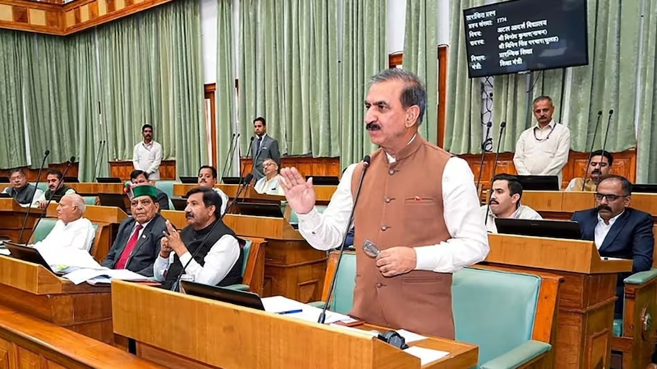
Anti-Defection Law Averts Political Crisis in Himachal Pradesh

Ensuring Safe Cancer Drugs is a Global Challenge

G.I. Tags: Cultural Shield or Just a Label?
Karol Bagh Metro Pillar No. 112, Above Domino's, 22B, First Floor, New Delhi - 110060
Very Important Instruction For Any Issue, Student Must Produce His/Her Fee Receipt. Without Fee Receipt, It Will Not Be Possible To Track Your Details. If You Have Been Given Any Special Consideration, You Must Keep That In Writing And Produce In Case Of Conflict.
Copyright © 2024-2026 ENSURE IAS. All rights reserved.