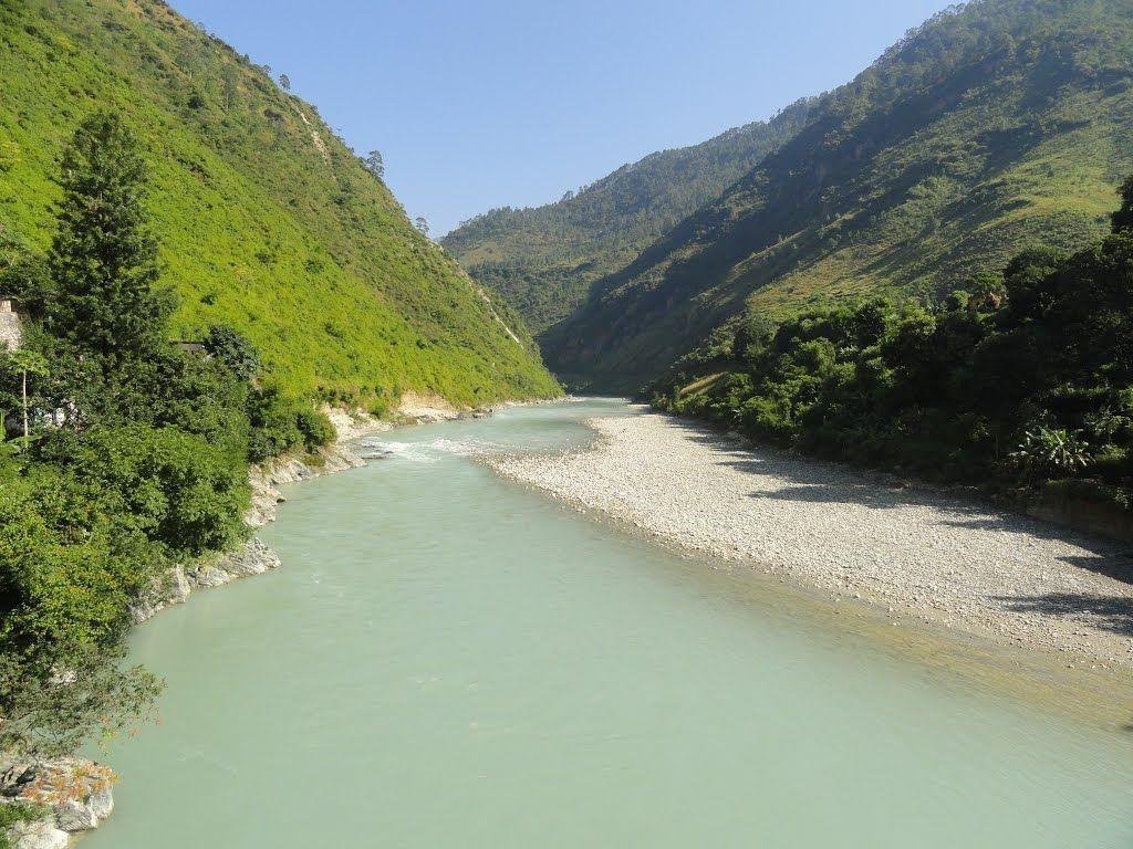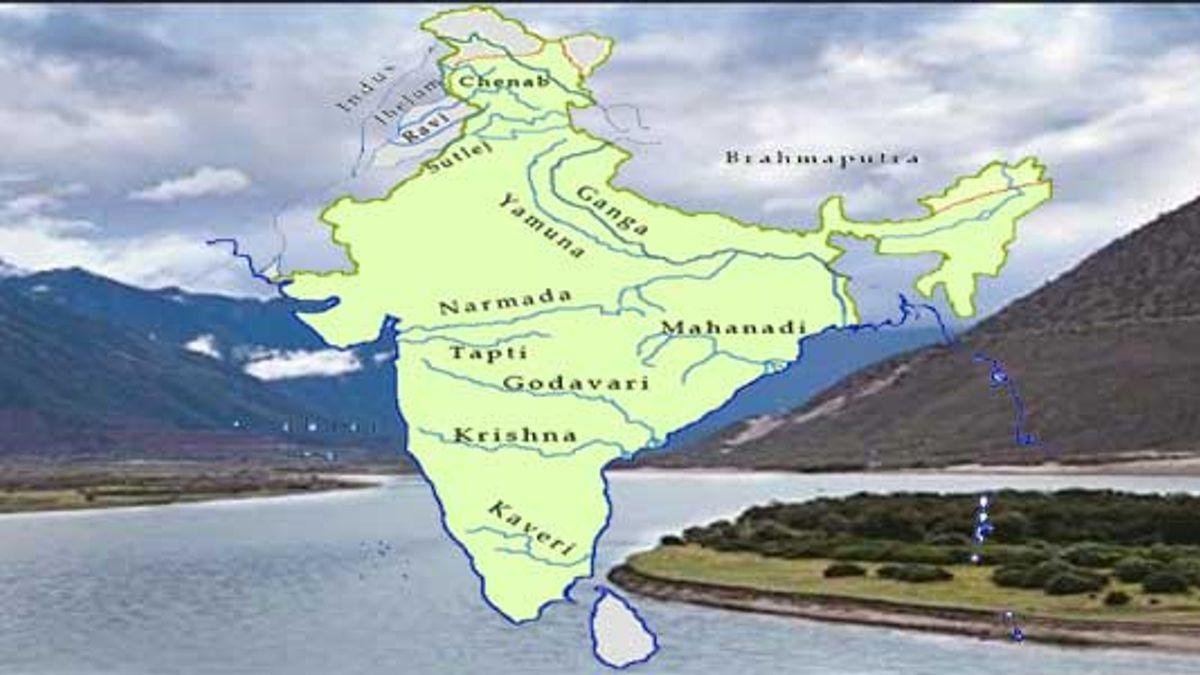
The river systems of India are the lifelines of its civilization, providing water for agriculture, energy for industries, and a spiritual foundation for millions. Indian rivers are geographically categorized into two groups: Himalayan Rivers (perennial, fed by glaciers) and Peninsular Rivers (seasonal, dependent on monsoons).
As of February 2026, the management and rejuvenation of these water bodies remain a national priority. Below is a comprehensive guide to the top 10 longest rivers in India, including their origins, tributaries, and geographical significance.
Comparison Table 10 Longest Rivers in India
| Rank | River | Length in India (km) | Total Length (km) | Origin | Discharge |
| 1 | Ganga | 2,525 | 2,525 | Gangotri Glacier, UK | Bay of Bengal |
| 2 | Godavari | 1,464 | 1,465 | Trimbak, Maharashtra | Bay of Bengal |
| 3 | Krishna | 1,400 | 1,400 | Mahabaleshwar, MH | Bay of Bengal |
| 4 | Yamuna | 1,376 | 1,376 | Yamunotri Glacier, UK | Confluence (Ganga) |
| 5 | Narmada | 1,312 | 1,312 | Amarkantak, MP | Arabian Sea |
| 6 | Indus | 1,114 | 3,180 | Mansarovar, Tibet | Arabian Sea |
| 7 | Brahmaputra | 916 | 2,900 | Angsi Glacier, Tibet | Bay of Bengal |
| 8 | Mahanadi | 890 | 890 | Sihawa Hills, Chhattisgarh | Bay of Bengal |
| 9 | Cauvery | 800 | 800 | Brahmagiri Hills, KA | Bay of Bengal |
| 10 | Tapi | 724 | 724 | Satpura Range, MP | Arabian Sea |
India’s Major Rivers: Important features
1. Ganga: The National River
The Ganga is the longest river flowing entirely through the Indian mainland. It is revered as a sacred goddess and forms the world’s largest delta (Sunderbans).
- Course: Flows through Uttarakhand, Uttar Pradesh, Bihar, Jharkhand, and West Bengal.
- Left Bank Tributaries: Ramganga, Gomti, Ghaghara, Gandak, Koshi, Mahananda.
- Right Bank Tributaries: Yamuna (largest), Son, Punpun, Tamsa.
2. Godavari: The Dakshina Ganga
The longest peninsular river, it is crucial for the Deccan region’s agriculture.
- Origin: Trimbakeshwar near Nashik, Maharashtra.
- Left bank Tributaries: Purna, Wardha, Pranhita, Indravati ;
- Right bank tributaries : Pravara, Manjira .
- States Covered: Maharashtra, Chhattisgarh, Telangana, Andhra Pradesh.
3. Krishna:
A vital source of irrigation for four states, known for its deep valleys and significant dams like Nagarjuna Sagar.
- Origin: Near Mahabaleshwar in the Western Ghats.
- Tributaries: Bhima, Musi, Munneru (Left); Koyna, Panchganga, Tungabhadra (Right).
4. Yamuna:
The primary tributary of the Ganga, it creates the highly fertile “Doab” region in North India.
- Origin: Yamunotri Glacier (Banderpoonch Peak).
- Left bank Tributaries:: Hindon;
- Right Bank Tributaries:Chambal, Betwa, Ken (Right).
- States Covered: Uttarakhand, Himachal Pradesh, Haryana, Delhi, Uttar Pradesh.
5. Narmada:
One of only three major rivers that flow from East to West, creating a rift valley between the Vindhya and Satpura ranges.
- Origin: Amarkantak Plateau, Madhya Pradesh.
- Significance: Often called the “Lifeline of MP and Gujarat.”
- Right bank Tributaries Hiran, Choral (Right);
- Left bank Tributaries:Banjar, Sher (Left).
6. Indus:
While its total length is immense, most of its course lies in Pakistan. In India, it flows through the strategic regions of Ladakh.
- Origin: Near Lake Mansarovar, Tibet.
- Cities: Leh and Skardu are major settlements on its banks.
- Tributaries: Jhelum, Chenab, Ravi, Beas, Satluj (The Panjnad).
7. Brahmaputra:
Known as the Tsangpo in Tibet, it enters India through Arunachal Pradesh and creates the massive river island of Majuli in Assam.
- Origin: Angsi Glacier, Kailash Range.
- Left bank Tributaries Lohit, Dibang, Dhansiri (Left);
- Right bank Tributaries:Manas, Teesta, Subansiri (Right).
- Identity: Becomes the Jamuna in Bangladesh before merging with the Ganga (Padma).
8. Mahanadi:
Historically known for devastating floods, it is now regulated by the Hirakud Dam, the world’s longest earthen dam.
- Origin: Sihawa Hills, Raipur (Chhattisgarh).
- Left bank Tributaries: Seonath, Hasdeo, Mand (Left);
- Right bank Tributaries:Ong, Tel (Right).
9. Cauvery:
The river is at the heart of intense inter-state water sharing. It forms a fertile delta known as the “Garden of Southern India.”
- Origin: Talakaveri in the Brahmagiri Range, Karnataka.
- Significance: Known for the Shivasamudram Falls.
- Left Bank tributaries: Harangi, Hemavati, Shimsha, Arkavati
- Right Bank tributaries: Lakshmana Tirtha, Kabini, Bhavani, Noyyal, Amaravati, Moyar
10. Tapi (Tapti):
Another significant west-flowing river that flows through a rift valley.
- Origin: Multai, Satpura Range in Madhya Pradesh.
- States: Flows through MP, Maharashtra, and Gujarat into the Gulf of Khambhat.
Key Geographical Facts
- West-Flowing Rivers: Narmada, Tapi, and Mahi are the major rivers that empty into the Arabian Sea instead of the Bay of Bengal.
- Majuli Island: Located in the Brahmaputra, it is the world’s largest mid-river deltaic island and India’s first river island district.
- Confluence (Prayagraj): The Yamuna merges with the Ganga at the “Sangam,” a site of massive religious importance (Kumbh Mela).
FAQs
Which is the longest river in India?
The Ganga is the longest river in India, stretching over 2,525 km within the country.
Which peninsular river is known as the “Dakshina Ganga”?
The Godavari is called the Dakshina Ganga due to its massive length and spiritual status in the south.
Which major Indian river flows from East to West?
The Narmada is the most prominent west-flowing river, running through a rift valley into the Arabian Sea.
What is the origin of the Brahmaputra river?
The Brahmaputra originates from the Angsi Glacier near Mount Kailash in Tibet.
Which river island is located in the Brahmaputra?
Majuli, the world’s largest river island, is located in the Brahmaputra river in Assam.
Where do the Ganga and Yamuna rivers meet?
They meet at the Triveni Sangam in Prayagraj (Allahabad), Uttar Pradesh.
Which river is known as the “Lifeline of Madhya Pradesh”?
The Narmada is considered the lifeline of Madhya Pradesh due to its vital role in irrigation and power.
What is the length of the Indus River within India?
The Indus flows for approximately 1,114 km through India before entering Pakistan.
Which river forms the “Garden of Southern India”?
The Cauvery river forms a fertile delta in Tamil Nadu that is often referred to by this name.
Which dam is built on the Mahanadi river?
The Hirakud Dam, the longest earthen dam in the world, is built across the Mahanadi near Sambalpur.