Context
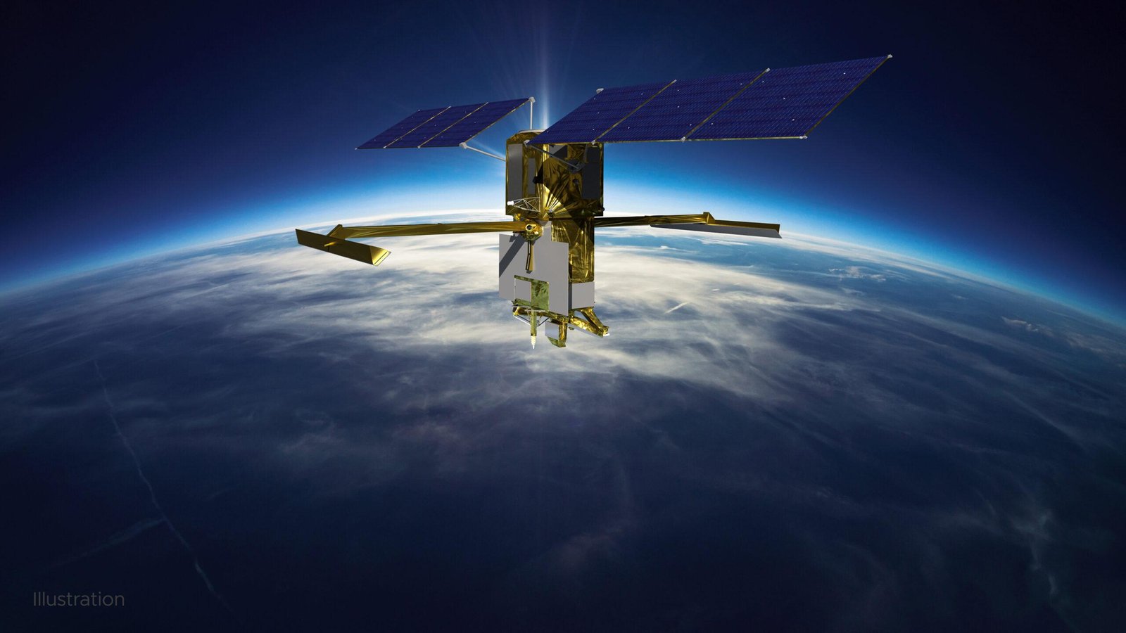
NASA has used data from the SWOT (Surface Water and Ocean Topography) satellite to create a new high-resolution map of the ocean floor, enhancing understanding of Earth’s water systems.
Q1. What is the SWOT Satellite?
- It is an Earth observation satellite launched in 2022 as a joint mission of NASA & CNES (France).
- Its main objective is to measure changes in Earth’s water bodies over time.
- It provides detailed data on oceans, rivers, lakes, and reservoirs.
Q2. What are the key features of the SWOT Satellite?
- It uses the Ka-band Radar Interferometer (KaRIn) to measure water surface height & elevation.
- It tracks width, depth, and flow of water bodies with high precision.
- It provides high spatial resolution data by using microwave signals.
- It can scan about 90% of Earth’s surface every 21 days.
- It covers over 55% of global floods during their lifecycle.
Q3. How does the SWOT Satellite work?
- It sends microwave radar signals towards Earth’s surface.
- The signals bounce back from water bodies, and the return time is measured.
- This helps calculate surface height and movement of water.
- It can detect small variations in elevation, even in ocean currents and eddies.
Q4. What is the significance of the SWOT Satellite?
- It improves understanding of global water cycles and climate change.
- It helps in monitoring floods, droughts, and water availability.
- It enhances mapping of ocean currents and underwater features.
- It supports research on heat and carbon absorption by oceans.
- It aids in water resource management and disaster preparedness.
Q5. What is the coverage and capability of SWOT Satellite?
- It can observe nearly all rivers wider than 330 feet.
- It monitors over 1 million lakes and reservoirs larger than 5 acres.
- It provides global-scale data with high precision and frequency.
- It captures fine-scale ocean features like currents and eddies.
Conclusion
The SWOT satellite marks a major advancement in global water monitoring, enabling better understanding of climate change, ocean dynamics, and water resource management.