Why in the News?
- A Union Environment Ministry panel recommended a new definition of the Aravalli mountain system, accepted by the Supreme Court.
- This definition drastically reduces Rajasthan’s Aravalli area by nearly 90%.
- Environmentalists fear this will open the region to more mining and degradation.
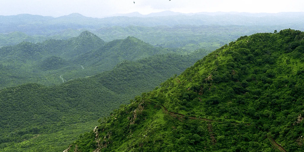
Background: The Aravallis and Their Ecological Importance
- One of the oldest mountain systems in the world, extending ~700 km from Gujarat → Rajasthan → Delhi → Haryana.
- Critical ecological roles:
- Acts as North India’s green lung.
- Recharges groundwater aquifers.
- Blocks desertification — stops the eastward spread of the Thar Desert.
- Moderates hot winds entering the Indo-Gangetic plains.
- Supports significant biodiversity and forest cover.
Earlier SC rulings (since 2002) consistently recognised the entire Aravalli landscape (hills, plateaus, plains, ridges) as a single interconnected ecosystem.
What has the Ministry Panel Recommended?
- Only landforms above 100 metres elevation will qualify as part of the Aravallis for mining-related decisions.
- This contradicts the Forest Survey of India (FSI) mapping, which uses 20 meters or higher as part of the mountain system.
- Out of 12,081 mapped Aravalli hills ≥20 m, only ~1,048 meet the new 100-m rule.
Impact: Nearly 90% of Rajasthan’s Aravalli range loses environmental protection.
Why is This new definition Problematic?
- It ignores scientific criteria
- The panel disregarded FSI’s comprehensive geomorphological mapping of the Aravalli hills.
- It contradicts the Environment Ministry’s own strategy
- The Aravalli Landscape Restoration Action Plan (May 2024) emphasises:
- Threats from mining, deforestation, encroachment, grazing.
- Notes desert sands encroaching into Gurugram, Alwar etc.
- The Aravalli Landscape Restoration Action Plan (May 2024) emphasises:
- The new definition weakens these protections.
- It goes against Supreme Court’s past environmental jurisprudence
- Earlier rulings stressed:
- Holistic ecological function of all Aravalli landforms.
- Quote (2018): “Without these hillocks, winds would bring pollution to the national capital.”
- It may worsen ecological degradation
- Already, ¼ of Aravalli hills are gone due to mining (SC CEC report, 2018).
- Lowering the definition allows mining in previously protected zones.
- It could also increase dust, pollution, and water scarcity across Delhi-NCR and Rajasthan.
- Earlier rulings stressed:
Implications
- More mining may be allowed in ecologically sensitive zones.
- Groundwater depletion is likely to worsen in Rajasthan, Haryana, Delhi.
- Desertification risk increases — desert may move eastward faster.
- Air pollution in Delhi-NCR may worsen without natural wind-barriers.
- Contradiction in government policy weakens environmental governance.
Challenges and Way Forward
| Challenges | Way Forward |
| New 100-m height rule excludes most Aravalli hills | Adopt FSI’s scientific mapping with 20-m threshold |
| Increased mining pressure | Greater SC and MoEFCC oversight; enforce closure of illegal mines |
| Disconnect between govt plans and panel recommendations | Align policy with Aravalli Restoration Action Plan |
| Desertification and climate vulnerability | Expand reforestation, grassland revival, and watershed restoration |
| Fragile ecosystem around NCR | Treat entire Aravalli landscape as a single ecological unit |
Conclusion
The Aravallis are a critical ecological shield for North India, yet the new height-based definition threatens to fragment and weaken this mountain system. Sustainable mining cannot be planned by shrinking ecological boundaries. Protecting the Aravallis requires aligning government policy, scientific mapping, and judicial oversight — ensuring that India’s oldest mountain range continues to safeguard millions.
| EnsureIAS Mains Question
Q. Discuss the ecological significance of the Aravalli mountain system and critically examine the implications of the recent redefinition of Aravalli hills for environmental governance in India. (250 Words) |
| EnsureIAS Prelims Question
Q. Consider the following statements regarding the Aravalli mountain system: 1. The Aravalli range plays a major role in checking the eastward spread of the Thar Desert. 2. The Forest Survey of India includes hills of 20 metres or more in its Aravalli mapping criteria. 3. The recent Environment Ministry panel recommended that only hills above 100 metres be treated as Aravalli for mining purposes. 4. The Aravalli Landscape Restoration Action Plan does not mention threats from grazing or human encroachment. Which of the statements given above are correct? Answer: (a) 1, 2 and 3 only Explanation: Statement 1 is Correct: Aravallis act as a natural barrier against desertification. Statement 2 is Correct: FSI includes hills ≥20 m in Aravalli mapping. Statement 3 is Correct: Ministry panel suggested the 100-m elevation filter. Statement 4 is Incorrect: The Action Plan explicitly mentions threats from deforestation, mining, grazing, and encroachment. |