Important questions for UPSC Pre/ Mains/ Interview:
|
Context
A study by IIT Gandhinagar warns that the Cauvery basin may see ~3.5% decline in water availability (2026–2050), raising concerns over water security, agriculture, and interstate conflicts.
Q1. What are the key geographical features of the Cauvery River Basin?
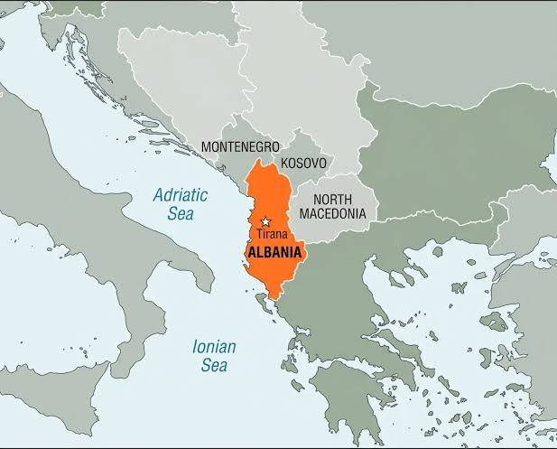
- The Cauvery is a major peninsular river system in South India.
- It originates at Talakaveri in the Brahmagiri Hills (Western Ghats, Karnataka).
- The river flows southeast & drains into the Bay of Bengal, forming a fertile delta in Tamil Nadu.
- It flows through Karnataka, Tamil Nadu, Kerala, and Puducherry.
- Important tributaries include Hemavati, Shimsha, Arkavathi, Kabini, Bhavani, and Amaravati.
- Major dams include Krishna Raja Sagar (KRS), Mettur, Kabini, and Hemavati projects.
Q2. Why is the Cauvery Basin significant for India?
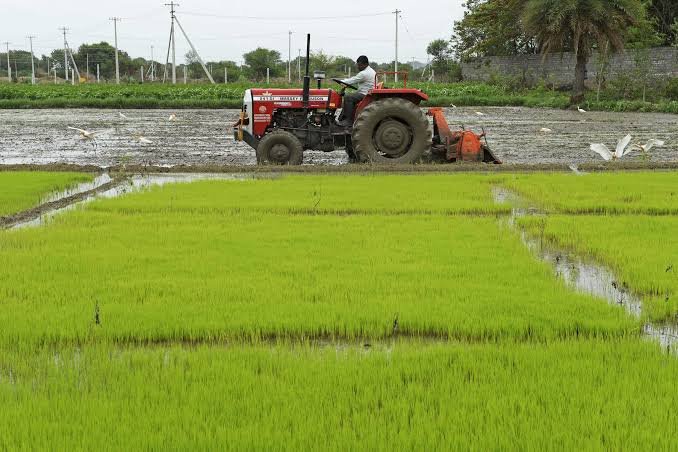
- It supports extensive agriculture, especially in Karnataka and Tamil Nadu.
- The Cauvery delta is known as the “Rice Bowl of South India” due to high rice production.
- It provides drinking water to major cities, including Bengaluru.
- It supports hydropower generation and irrigation infrastructure.
- It is central to a long-standing interstate water dispute involving multiple states.
Q3. What are the key findings of the recent study on the Cauvery Basin?
- The study projects a decline of around 3.5% in water availability between 2026–2050.
- This trend is different from many global river systems, where water availability may increase due to glacial melt. It highlights that the Cauvery basin is highly vulnerable to climate variability.
Q4. Why is water availability declining in the Cauvery Basin despite global warming?
- The Cauvery is a rain-fed (non-glacial) river, making it heavily dependent on monsoons.
- Erratic and declining rainfall patterns reduce water inflow into the basin.
- Rising temperatures increase evaporation, leading to water loss.
- Over-extraction of water for agriculture and urban use reduces availability.
- Groundwater depletion further worsens water stress.
- Land use changes, such as urbanisation and deforestation in the Western Ghats, disrupt natural water cycles.
Q5. What are the implications of declining water availability in the Cauvery Basin?
- It may lead to an agricultural crisis, reducing irrigation and crop yields.
- It can worsen food security, especially in rice-producing regions.
- It may intensify interstate water disputes, increasing political and social tensions.
- Urban centres like Bengaluru may face severe water shortages.
- Ecologically, it can cause wetland degradation and salinity intrusion in coastal areas.
Q6. What are the challenges and what measures can be taken to address water stress in the Cauvery Basin?
| Challenges | Measures to Address Them |
| 1. High dependence on uncertain monsoon | Promote climate-resilient and diversified agriculture |
| 2. Excessive water use in farming | Adopt micro-irrigation methods like drip & sprinkler systems |
| 3. Interstate water conflicts | Strengthen cooperative river basin governance mechanisms |
| 4. Rapid groundwater depletion | Regulate extraction and promote recharge techniques |
| 5. Degradation of delta ecosystems | Restore wetlands and coastal ecosystems |
| 6. Inefficient water management | Implement Integrated River Basin Management (IRBM) |
Conclusion
The Cauvery basin shows that climate change impacts are uneven, making it essential to adopt sustainable water management, scientific planning, and cooperative federalism to ensure long-term water security.