The Brahmaputra River System is one of the most majestic and ecologically vital transboundary river systems in the world. Often referred to as the “Son of Brahma,” it acts as the lifeline for Northeast India and Bangladesh, supporting massive biodiversity, agriculture, and an immense hydropower potential of approximately 66,065 MW.
1. Geographical Profile and Course
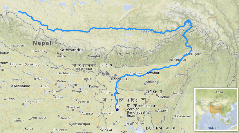
The Brahmaputra is a major transboundary river that flows through three countries: China (Tibet), India, and Bangladesh.
- Origin: It rises from the Chemayungdung Glacier (near Mount Kailash) in the Angsi Glacier region of southwestern Tibet.
- Journey in Tibet: Known here as the Yarlung Tsangpo (The Purifier), it flows eastward for nearly 1,100 km across the Tibetan Plateau at a high altitude before making a sharp “U-turn” at Namcha Barwa.
- Entry into India: It enters India through Arunachal Pradesh, where it is known as the Siang or Dihang.
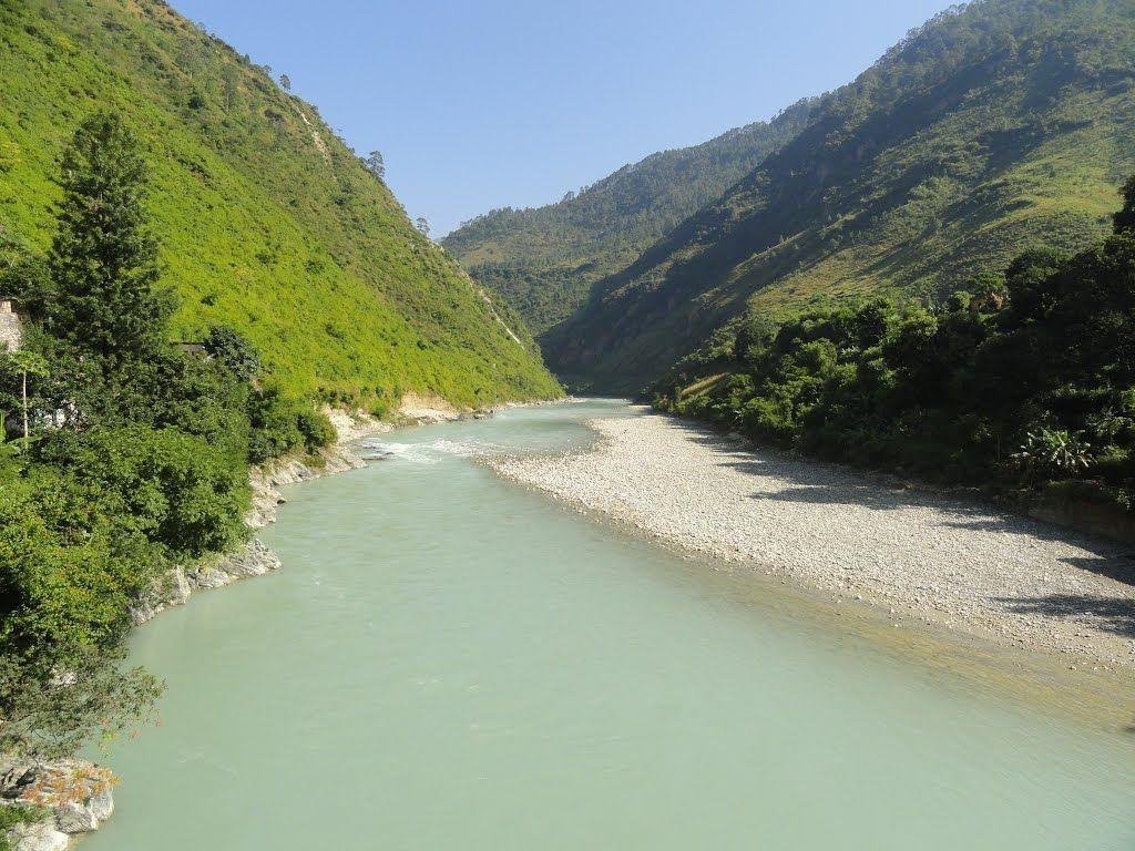
- The Assam Valley: After being joined by the Dibang and Lohit rivers near Sadiya, it takes the name Brahmaputra. It flows majestically through a braided channel across the Assam plains.
- Termination: It enters Bangladesh as the Jamuna, merges with the Padma (Ganga), and finally joins the Meghna before emptying into the Bay of Bengal.
2. Key Physical and Ecological Features
The Brahmaputra basin is unique for its biodiversity and its significant contribution to India’s green cover.
- Basin Boundaries: Surrounded by the Himalayas (North and West), Patkai Hills (East), and Assam Hills (South).
- Majuli Island: Located in Assam, it is the world’s largest and oldest inhabited river island, recognized by UNESCO.
- Forest Cover: The basin states (Sikkim and Arunachal Pradesh) account for 48% of India’s total forest cover.
- Sediment and Monsoons: The river is an “active silt-depositor.” It receives 85% of its annual rainfall between May and September (South-West monsoon), leading to frequent seasonal flooding.
3. Tributaries of the Brahmaputra
The system is fed by 20 tributaries on the north bank and 13 on the south bank, significantly increasing its volume and power.
Left-Bank (Northern) Tributaries
| Tributary Name | Origin | Key Significance |
| Lhasa River | Tibet | Major contributor to the Tsangpo’s upper flow. |
| Subansiri | Tibet | The largest tributary; site of major hydro projects. |
| Kameng | Arunachal Pradesh | Supports rich biodiversity in West Kameng. |
| Lohit | Eastern Tibet | Joins the Siang to form the Brahmaputra; known for rapid flow. |
| Dhansiri (North) | Nagaland | Vital for irrigation in sensitive ecological zones. |
Right-Bank (Southern) Tributaries
| Tributary Name | Origin | Key Significance |
| Manas | Bhutan Himalayas | Flows through a UNESCO World Heritage wildlife site. |
| Teesta | Sikkim (Pauhunri Glacier) | Vital for Indo-Bangladesh water sharing and hydro power. |
| Kopili | Meghalaya Hills | Major source for irrigation and power in Assam. |
| Jaldhaka | Sikkim-Bhutan border | Key transboundary river for cross-border cooperation. |
| Sonkosh | Bhutan | Borders Assam and West Bengal; supports irrigation. |
4. Nomenclature Across Regions
The Brahmaputra changes its name as frequently as its course, reflecting the cultural diversity of the regions it touches.
| Region | Name |
| Tibet | Tsangpo (meaning “The Purifier”) |
| China | Yarlung Zangbo / Jiangin |
| Arunachal Pradesh | Siang / Dihang |
| Assam Valley | Brahmaputra |
| Bangladesh | Jamuna |
| Confluence (Ganga + Brahmaputra) | Padma |
| Final Confluence before Sea | Meghna |
5. Major Infrastructure and Hydro Projects
The river’s high discharge makes it a powerhouse for renewable energy development.
- International Projects: Zangmu Dam (Operational in Tibet); Dagu and Jiexu (Proposed in Tibet).
- Indian Projects: Upper & Lower Subansiri (Under Construction); Teesta-V (Completed); Rangit (Completed).
- Bhutanese Projects: Chukha, Tala, and Kurichu (Operational).
FAQs on the Brahmaputra River System
Which glacier is the primary source of the Brahmaputra?
The river originates from the Chemayungdung Glacier near Mount Kailash in the Angsi Glacier region of Tibet.
What is the river called in Tibet?
In Tibet, the river is known as the Tsangpo, which translates to “The Purifier.”
Which is the largest river island in the world?
Majuli Island, located in the Brahmaputra River in Assam, is the largest inhabited river island globally.
What is the name of the Brahmaputra as it enters Bangladesh?
As it enters Bangladesh, the Brahmaputra adopts the name Jamuna River.
Why is the Brahmaputra often called the “Red River”?
It is called the Red River due to the high content of iron-rich red soil it carries, which turns the water reddish during the monsoon.
Which Indian state does the Brahmaputra first enter?
The river first enters India through the state of Arunachal Pradesh, where it is initially called the Siang.
What is the combined name of the Ganga and Brahmaputra in Bangladesh?
The combined waters of the two rivers are known as the Padma River.
Which is the largest tributary of the Brahmaputra?
The Subansiri River is the largest tributary of the Brahmaputra River System.
Which UNESCO World Heritage site is supported by the Manas River?
The Manas National Park and Wildlife Sanctuary is supported by the Manas River in Assam.
How much hydropower potential does the Brahmaputra system have?
The system has a massive estimated hydropower potential of 66,065 MW.